All 50 US states, in interactive 3D elevation.
The 50 states run almost the full range of North American terrain — from Denali in Alaska, the highest point on the continent, to the floor of Death Valley in California, the lowest land in North America. This page maps every one in true 3D, each cut from the same Copernicus GLO-30 satellite model to its state line.
Open any state and it renders as real terrain you can grab, tilt and spin, with the figures computed straight from the model — highest and lowest points, mean and median elevation. A colour map tells you a state has mountains; the 3D model shows how high they stand.
See it in 3D
Three states, three kinds of terrain
Colorado’s Rocky Mountain high country, California’s Sierra Nevada dropping to Death Valley below sea level, and Alaska’s Denali. Each map below is live — scroll to it and it loads in 3D; drag to spin it, and open the full page for its elevation profile.
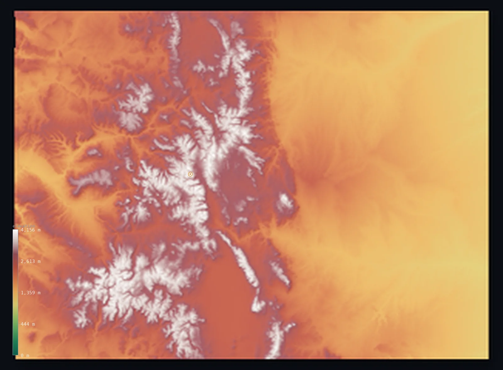
Highest point Mount Elbert, 4,401 m
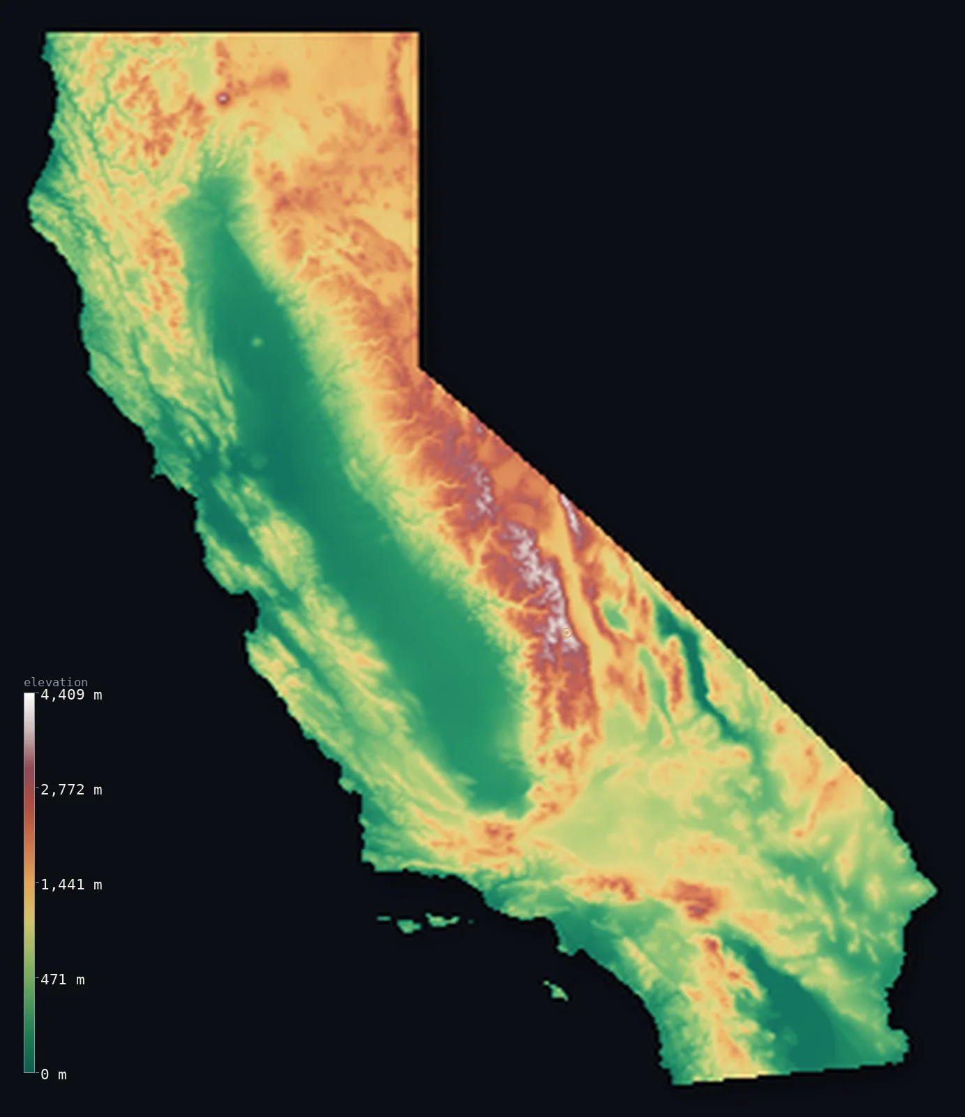
Highest point Mount Whitney, 4,421 m
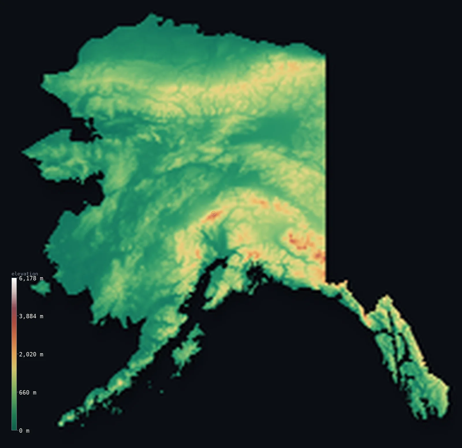
Highest point Denali, 6,190 m
Browse
All 50 states
Grouped by region, alphabetical within each. Every card opens that state’s full 3D map and elevation statistics.
West · 13
- Alaska
A dramatic 20,308 ft (6,190 m) of relief separates the Pacific Ocean from Denali. Most of it lies far lower, though — half the land sits below 961 ft (293 m).
- Highest
- Denali · 20,308 ft (6,190 m)
- Lowest
- Pacific Ocean · sea level
- Mean
- 1,496 ft (456 m)
- · Median
- 961 ft (293 m)
- Arizona
A high state — half its land lies above 4,596 ft (1,401 m), rising to Humphreys Peak. Its mean elevation is 4,216 ft (1,285 m).
- Highest
- Humphreys Peak · 12,638 ft (3,852 m)
- Lowest
- Colorado River · 72 ft (22 m)
- Mean
- 4,216 ft (1,285 m)
- · Median
- 4,596 ft (1,401 m)
- California
A dramatic 14,787 ft (4,507 m) of relief separates the Badwater Basin, Death Valley from Mount Whitney. Its lowest ground, the Badwater Basin, Death Valley, lies below the sea, at −282 ft (−86 m).
- Highest
- Mount Whitney · 14,505 ft (4,421 m)
- Lowest
- Badwater Basin, Death Valley · −282 ft (−86 m)
- Mean
- 2,802 ft (854 m)
- · Median
- 2,300 ft (701 m)
- Colorado
A high state — half its land lies above 6,542 ft (1,994 m), rising to Mount Elbert. Its mean elevation is 6,867 ft (2,093 m).
- Highest
- Mount Elbert · 14,439 ft (4,401 m)
- Lowest
- Arikaree River · 3,317 ft (1,011 m)
- Mean
- 6,867 ft (2,093 m)
- · Median
- 6,542 ft (1,994 m)
- Hawaii
A dramatic 13,796 ft (4,205 m) of relief separates the Pacific Ocean from Mauna Kea. Half its land lies below 3,307 ft (1,008 m).
- Highest
- Mauna Kea · 13,796 ft (4,205 m)
- Lowest
- Pacific Ocean · sea level
- Mean
- 3,904 ft (1,190 m)
- · Median
- 3,307 ft (1,008 m)
- Idaho
A high state — half its land lies above 5,177 ft (1,578 m), rising to Borah Peak. Its mean elevation is 5,240 ft (1,597 m).
- Highest
- Borah Peak · 12,661 ft (3,859 m)
- Lowest
- Lewiston (Snake River) · 709 ft (216 m)
- Mean
- 5,240 ft (1,597 m)
- · Median
- 5,177 ft (1,578 m)
- Montana
Its land ranges 11,007 ft (3,355 m), from the Kootenai River up to Granite Peak. Half its land lies below 3,599 ft (1,097 m).
- Highest
- Granite Peak · 12,808 ft (3,904 m)
- Lowest
- Kootenai River · 1,801 ft (549 m)
- Mean
- 4,137 ft (1,261 m)
- · Median
- 3,599 ft (1,097 m)
- Nevada
A high state — half its land lies above 5,620 ft (1,713 m), rising to Boundary Peak. Its mean elevation is 5,528 ft (1,685 m).
- Highest
- Boundary Peak · 13,140 ft (4,005 m)
- Lowest
- Colorado River · 472 ft (144 m)
- Mean
- 5,528 ft (1,685 m)
- · Median
- 5,620 ft (1,713 m)
- New Mexico
A high state — half its land lies above 5,689 ft (1,734 m), rising to Wheeler Peak. Its mean elevation is 5,774 ft (1,760 m).
- Highest
- Wheeler Peak · 13,166 ft (4,013 m)
- Lowest
- Red Bluff Reservoir · 2,818 ft (859 m)
- Mean
- 5,774 ft (1,760 m)
- · Median
- 5,689 ft (1,734 m)
- Oregon
A high state — half its land lies above 4,039 ft (1,231 m), rising to Mount Hood. Its mean elevation is 3,533 ft (1,077 m).
- Highest
- Mount Hood · 11,250 ft (3,429 m)
- Lowest
- Pacific Ocean · sea level
- Mean
- 3,533 ft (1,077 m)
- · Median
- 4,039 ft (1,231 m)
- Utah
A high state — half its land lies above 5,676 ft (1,730 m), rising to Kings Peak. Its mean elevation is 6,014 ft (1,833 m).
- Highest
- Kings Peak · 13,517 ft (4,120 m)
- Lowest
- Beaver Dam Wash · 2,001 ft (610 m)
- Mean
- 6,014 ft (1,833 m)
- · Median
- 5,676 ft (1,730 m)
- Washington
A dramatic 14,409 ft (4,392 m) of relief separates the Pacific Ocean from Mount Rainier. Half its land lies below 2,080 ft (634 m).
- Highest
- Mount Rainier · 14,409 ft (4,392 m)
- Lowest
- Pacific Ocean · sea level
- Mean
- 2,290 ft (698 m)
- · Median
- 2,080 ft (634 m)
- Wyoming
A high state — half its land lies above 6,549 ft (1,996 m), rising to Gannett Peak. Its mean elevation is 6,398 ft (1,950 m).
- Highest
- Gannett Peak · 13,809 ft (4,209 m)
- Lowest
- Belle Fourche River · 3,100 ft (945 m)
- Mean
- 6,398 ft (1,950 m)
- · Median
- 6,549 ft (1,996 m)
Midwest · 12
- Illinois
Its land ranges 955 ft (291 m), from the Mississippi River up to Charles Mound. Half its land lies below 636 ft (194 m).
- Highest
- Charles Mound · 1,234 ft (376 m)
- Lowest
- Mississippi River · 279 ft (85 m)
- Mean
- 627 ft (191 m)
- · Median
- 636 ft (194 m)
- Indiana
Its land ranges 935 ft (285 m), from the Ohio River up to Hoosier Hill. Half its land lies below 768 ft (234 m).
- Highest
- Hoosier Hill · 1,257 ft (383 m)
- Lowest
- Ohio River · 322 ft (98 m)
- Mean
- 751 ft (229 m)
- · Median
- 768 ft (234 m)
- Iowa
Its land ranges 1,191 ft (363 m), from the Mississippi River up to Hawkeye Point. Half its land lies below 1,086 ft (331 m).
- Highest
- Hawkeye Point · 1,670 ft (509 m)
- Lowest
- Mississippi River · 479 ft (146 m)
- Mean
- 1,066 ft (325 m)
- · Median
- 1,086 ft (331 m)
- Kansas
Its land ranges 3,363 ft (1,025 m), from the Verdigris River up to Mount Sunflower. Half its land lies below 1,660 ft (506 m).
- Highest
- Mount Sunflower · 4,042 ft (1,232 m)
- Lowest
- Verdigris River · 679 ft (207 m)
- Mean
- 1,909 ft (582 m)
- · Median
- 1,660 ft (506 m)
- Michigan
Its land ranges 1,407 ft (429 m), from Lake Erie up to Mount Arvon. Half its land lies below 850 ft (259 m).
- Highest
- Mount Arvon · 1,978 ft (603 m)
- Lowest
- Lake Erie · 571 ft (174 m)
- Mean
- 912 ft (278 m)
- · Median
- 850 ft (259 m)
- Minnesota
Its land ranges 1,699 ft (518 m), from Lake Superior up to Eagle Mountain. Half its land lies below 1,211 ft (369 m).
- Highest
- Eagle Mountain · 2,300 ft (701 m)
- Lowest
- Lake Superior · 600 ft (183 m)
- Mean
- 1,220 ft (372 m)
- · Median
- 1,211 ft (369 m)
- Missouri
Its land ranges 1,542 ft (470 m), from the St. Francis River up to Taum Sauk Mountain. Half its land lies below 856 ft (261 m).
- Highest
- Taum Sauk Mountain · 1,772 ft (540 m)
- Lowest
- St. Francis River · 230 ft (70 m)
- Mean
- 860 ft (262 m)
- · Median
- 856 ft (261 m)
- Nebraska
Its land ranges 4,583 ft (1,397 m), from the Missouri River up to Panorama Point. Half its land lies below 2,480 ft (756 m).
- Highest
- Panorama Point · 5,423 ft (1,653 m)
- Lowest
- Missouri River · 840 ft (256 m)
- Mean
- 2,605 ft (794 m)
- · Median
- 2,480 ft (756 m)
- North Dakota
Its land ranges 2,756 ft (840 m), from the Red River of the North up to White Butte. Half its land lies below 1,841 ft (561 m).
- Highest
- White Butte · 3,507 ft (1,069 m)
- Lowest
- Red River of the North · 751 ft (229 m)
- Mean
- 1,827 ft (557 m)
- · Median
- 1,841 ft (561 m)
- Ohio
Its land ranges 1,093 ft (333 m), from the Ohio River up to Campbell Hill. Half its land lies below 942 ft (287 m).
- Highest
- Campbell Hill · 1,549 ft (472 m)
- Lowest
- Ohio River · 456 ft (139 m)
- Mean
- 935 ft (285 m)
- · Median
- 942 ft (287 m)
- South Dakota
Its land ranges 6,273 ft (1,912 m), from Big Stone Lake up to Black Elk Peak. Half its land lies below 1,932 ft (589 m).
- Highest
- Black Elk Peak · 7,241 ft (2,207 m)
- Lowest
- Big Stone Lake · 968 ft (295 m)
- Mean
- 2,185 ft (666 m)
- · Median
- 1,932 ft (589 m)
- Wisconsin
Its land ranges 1,375 ft (419 m), from Lake Michigan up to Timms Hill. Half its land lies below 1,033 ft (315 m).
- Highest
- Timms Hill · 1,952 ft (595 m)
- Lowest
- Lake Michigan · 577 ft (176 m)
- Mean
- 1,093 ft (333 m)
- · Median
- 1,033 ft (315 m)
South · 16
- Alabama
Its land ranges 2,411 ft (735 m), from the Gulf of Mexico up to Cheaha Mountain. Half its land lies below 410 ft (125 m).
- Highest
- Cheaha Mountain · 2,411 ft (735 m)
- Lowest
- Gulf of Mexico · sea level
- Mean
- 476 ft (145 m)
- · Median
- 410 ft (125 m)
- Arkansas
Its land ranges 2,697 ft (822 m), from the Ouachita River up to Magazine Mountain. Half its land lies below 338 ft (103 m).
- Highest
- Magazine Mountain · 2,753 ft (839 m)
- Lowest
- Ouachita River · 56 ft (17 m)
- Mean
- 541 ft (165 m)
- · Median
- 338 ft (103 m)
- Delaware
Nearly flat: Ebright Azimuth stands just 449 ft (137 m) above the Atlantic Ocean. Its average elevation is just 61 ft (18.5 m).
- Highest
- Ebright Azimuth · 449 ft (137 m)
- Lowest
- Atlantic Ocean · sea level
- Mean
- 61 ft (18.5 m)
- · Median
- 49 ft (15 m)
- Florida
Nearly flat: Britton Hill stands just 344 ft (105 m) above the Atlantic Ocean. Its average elevation is just 70 ft (21.3 m).
- Highest
- Britton Hill · 344 ft (105 m)
- Lowest
- Atlantic Ocean · sea level
- Mean
- 70 ft (21.3 m)
- · Median
- 57 ft (17.4 m)
- Georgia
Its land ranges 4,783 ft (1,458 m), from the Atlantic Ocean up to Brasstown Bald. Half its land lies below 364 ft (111 m).
- Highest
- Brasstown Bald · 4,783 ft (1,458 m)
- Lowest
- Atlantic Ocean · sea level
- Mean
- 522 ft (159 m)
- · Median
- 364 ft (111 m)
- Kentucky
Its land ranges 3,888 ft (1,185 m), from the Mississippi River up to Black Mountain. Half its land lies below 804 ft (245 m).
- Highest
- Black Mountain · 4,144 ft (1,263 m)
- Lowest
- Mississippi River · 256 ft (78 m)
- Mean
- 840 ft (256 m)
- · Median
- 804 ft (245 m)
- Louisiana
Nearly flat: Driskill Mountain stands just 541 ft (165 m) above New Orleans (below sea level). Its lowest ground, New Orleans (below sea level), lies below the sea, at −7 ft (−2 m).
- Highest
- Driskill Mountain · 535 ft (163 m)
- Lowest
- New Orleans (below sea level) · −7 ft (−2 m)
- Mean
- 108 ft (32.8 m)
- · Median
- 76 ft (23.1 m)
- Maryland
Its land ranges 3,360 ft (1,024 m), from the Atlantic Ocean up to Hoye-Crest (Backbone Mountain). Half its land lies below 159 ft (48.6 m).
- Highest
- Hoye-Crest (Backbone Mountain) · 3,360 ft (1,024 m)
- Lowest
- Atlantic Ocean · sea level
- Mean
- 429 ft (131 m)
- · Median
- 159 ft (48.6 m)
- Mississippi
Nearly flat: Woodall Mountain stands just 807 ft (246 m) above the Gulf of Mexico. Its average elevation is just 305 ft (92.9 m).
- Highest
- Woodall Mountain · 807 ft (246 m)
- Lowest
- Gulf of Mexico · sea level
- Mean
- 305 ft (92.9 m)
- · Median
- 311 ft (94.9 m)
- North Carolina
Its land ranges 6,683 ft (2,037 m), from the Atlantic Ocean up to Mount Mitchell. Half its land lies below 358 ft (109 m).
- Highest
- Mount Mitchell · 6,683 ft (2,037 m)
- Lowest
- Atlantic Ocean · sea level
- Mean
- 771 ft (235 m)
- · Median
- 358 ft (109 m)
- Oklahoma
Its land ranges 4,685 ft (1,428 m), from the Little River up to Black Mesa. Half its land lies below 1,066 ft (325 m).
- Highest
- Black Mesa · 4,974 ft (1,516 m)
- Lowest
- Little River · 289 ft (88 m)
- Mean
- 1,293 ft (394 m)
- · Median
- 1,066 ft (325 m)
- South Carolina
Its land ranges 3,560 ft (1,085 m), from the Atlantic Ocean up to Sassafras Mountain. Half its land lies below 233 ft (71 m).
- Highest
- Sassafras Mountain · 3,560 ft (1,085 m)
- Lowest
- Atlantic Ocean · sea level
- Mean
- 341 ft (104 m)
- · Median
- 233 ft (71 m)
- Tennessee
Its land ranges 6,467 ft (1,971 m), from the Mississippi River up to Clingmans Dome. Half its land lies below 827 ft (252 m).
- Highest
- Clingmans Dome · 6,644 ft (2,025 m)
- Lowest
- Mississippi River · 177 ft (54 m)
- Mean
- 965 ft (294 m)
- · Median
- 827 ft (252 m)
- Texas
Its land ranges 8,750 ft (2,667 m), from the Gulf of Mexico up to Guadalupe Peak. Half its land lies below 1,332 ft (406 m).
- Highest
- Guadalupe Peak · 8,750 ft (2,667 m)
- Lowest
- Gulf of Mexico · sea level
- Mean
- 1,657 ft (505 m)
- · Median
- 1,332 ft (406 m)
- Virginia
Its land ranges 5,728 ft (1,746 m), from the Atlantic Ocean up to Mount Rogers. Half its land lies below 604 ft (184 m).
- Highest
- Mount Rogers · 5,728 ft (1,746 m)
- Lowest
- Atlantic Ocean · sea level
- Mean
- 1,010 ft (308 m)
- · Median
- 604 ft (184 m)
- West Virginia
Its land ranges 4,623 ft (1,409 m), from the Potomac River up to Spruce Knob. Half its land lies below 1,430 ft (436 m).
- Highest
- Spruce Knob · 4,862 ft (1,482 m)
- Lowest
- Potomac River · 240 ft (73 m)
- Mean
- 1,699 ft (518 m)
- · Median
- 1,430 ft (436 m)
Northeast · 9
- Connecticut
Its land ranges 2,379 ft (725 m), from the Long Island Sound up to Mount Frissell (south slope). Half its land lies below 430 ft (131 m).
- Highest
- Mount Frissell (south slope) · 2,379 ft (725 m)
- Lowest
- Long Island Sound · sea level
- Mean
- 489 ft (149 m)
- · Median
- 430 ft (131 m)
- Maine
Its land ranges 5,269 ft (1,606 m), from the Atlantic Ocean up to Mount Katahdin. Half its land lies below 636 ft (194 m).
- Highest
- Mount Katahdin · 5,269 ft (1,606 m)
- Lowest
- Atlantic Ocean · sea level
- Mean
- 771 ft (235 m)
- · Median
- 636 ft (194 m)
- Massachusetts
Its land ranges 3,488 ft (1,063 m), from the Atlantic Ocean up to Mount Greylock. Half its land lies below 328 ft (100 m).
- Highest
- Mount Greylock · 3,488 ft (1,063 m)
- Lowest
- Atlantic Ocean · sea level
- Mean
- 558 ft (170 m)
- · Median
- 328 ft (100 m)
- New Hampshire
Its land ranges 6,289 ft (1,917 m), from the Atlantic Ocean up to Mount Washington. Half its land lies below 1,027 ft (313 m).
- Highest
- Mount Washington · 6,289 ft (1,917 m)
- Lowest
- Atlantic Ocean · sea level
- Mean
- 1,152 ft (351 m)
- · Median
- 1,027 ft (313 m)
- New Jersey
Its land ranges 1,804 ft (550 m), from the Atlantic Ocean up to High Point. Half its land lies below 112 ft (34 m).
- Highest
- High Point · 1,804 ft (550 m)
- Lowest
- Atlantic Ocean · sea level
- Mean
- 240 ft (73.3 m)
- · Median
- 112 ft (34 m)
- New York
Its land ranges 5,344 ft (1,629 m), from the Atlantic Ocean up to Mount Marcy. Half its land lies below 1,142 ft (348 m).
- Highest
- Mount Marcy · 5,344 ft (1,629 m)
- Lowest
- Atlantic Ocean · sea level
- Mean
- 1,125 ft (343 m)
- · Median
- 1,142 ft (348 m)
- Pennsylvania
Its land ranges 3,212 ft (979 m), from the Delaware River up to Mount Davis. Half its land lies below 1,273 ft (388 m).
- Highest
- Mount Davis · 3,212 ft (979 m)
- Lowest
- Delaware River · sea level
- Mean
- 1,270 ft (387 m)
- · Median
- 1,273 ft (388 m)
- Rhode Island
Nearly flat: Jerimoth Hill stands just 810 ft (247 m) above the Atlantic Ocean. Its average elevation is just 270 ft (82.2 m).
- Highest
- Jerimoth Hill · 810 ft (247 m)
- Lowest
- Atlantic Ocean · sea level
- Mean
- 270 ft (82.2 m)
- · Median
- 235 ft (71.7 m)
- Vermont
Its land ranges 4,298 ft (1,310 m), from Lake Champlain up to Mount Mansfield. Half its land lies below 1,224 ft (373 m).
- Highest
- Mount Mansfield · 4,393 ft (1,339 m)
- Lowest
- Lake Champlain · 95 ft (29 m)
- Mean
- 1,234 ft (376 m)
- · Median
- 1,224 ft (373 m)
Explore the rest
US city elevations →All 194 countries →The 7 continents →The whole world →Home →
Rendered from Copernicus GLO-30 (ESA); state boundaries from geoBoundaries (USA ADM1). Every figure traces to the elevation model or a sourced dossier.