The seven continents, in 3D elevation.
Seven landmasses hold almost all of Earth’s dry ground, and this page maps each one in true 3D — every continent cut from the same Copernicus GLO-30 satellite model, on one scale. They run from Mount Everest at 8,849 m, the highest point on Earth, down to basins that drop below sea level. Open any one and it renders as terrain you can tilt and spin.
Most of that ground sits low. Earth’s median elevation is 426 m, well under its 801 m mean — because the ranges that give a continent its name, the Himalaya and the Andes, are a thin band of high country riding a vast low surface. A flat colour map turns that into hue; the 3D model shows how far the high ground actually stands above the rest.
See it in 3D
Three continents, three kinds of terrain
Asia’s Himalayan wall, the Andes running the length of South America, and Africa’s high plateau. Each map below is live — scroll to it and it loads in 3D; drag to spin it, and open the full page for its elevation profile.
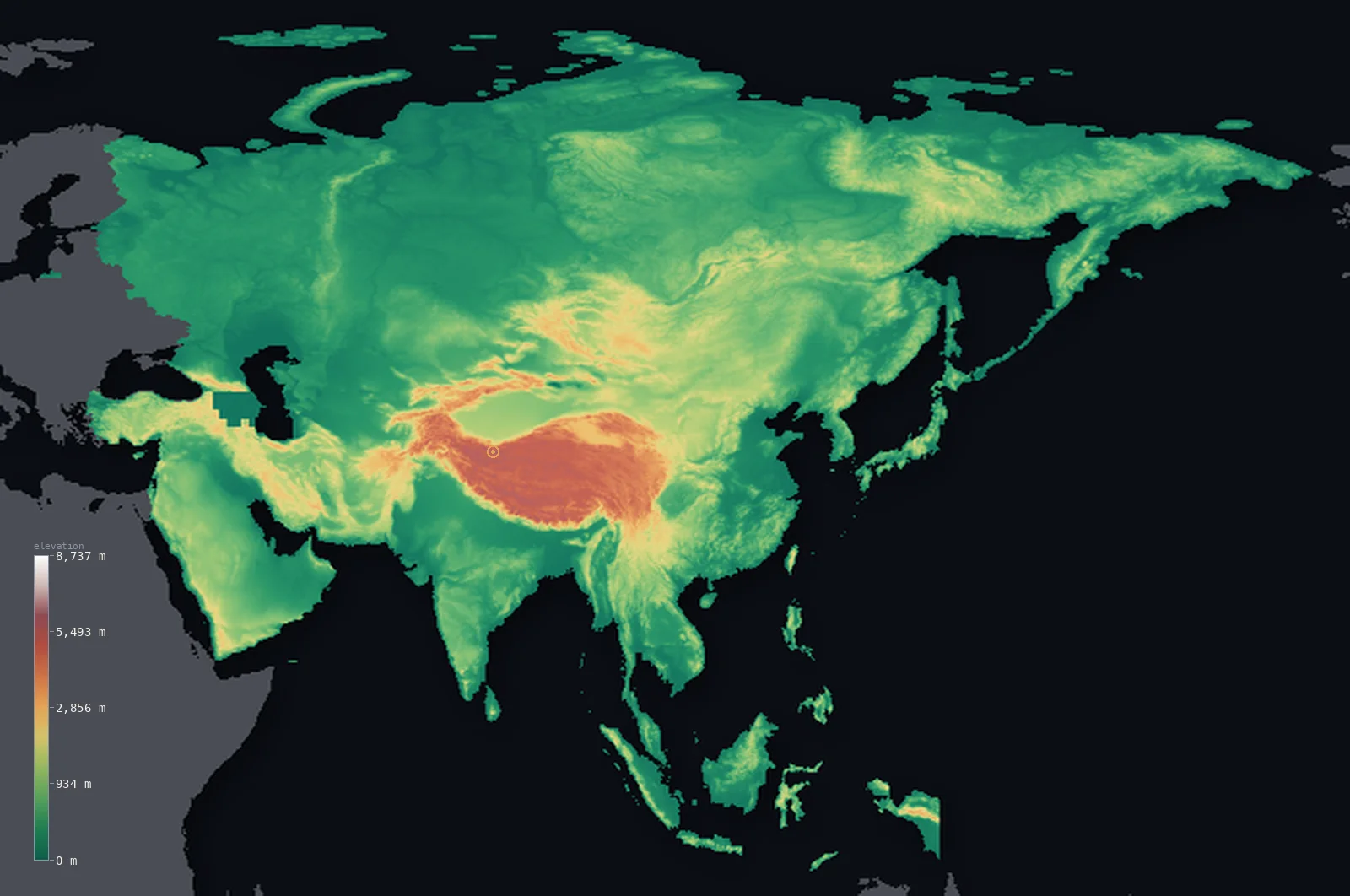
Highest point Mount Everest, 8,849 m
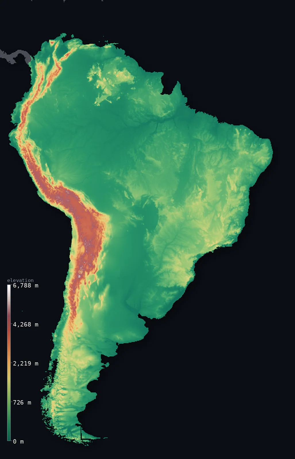
Highest point Aconcagua, 6,961 m
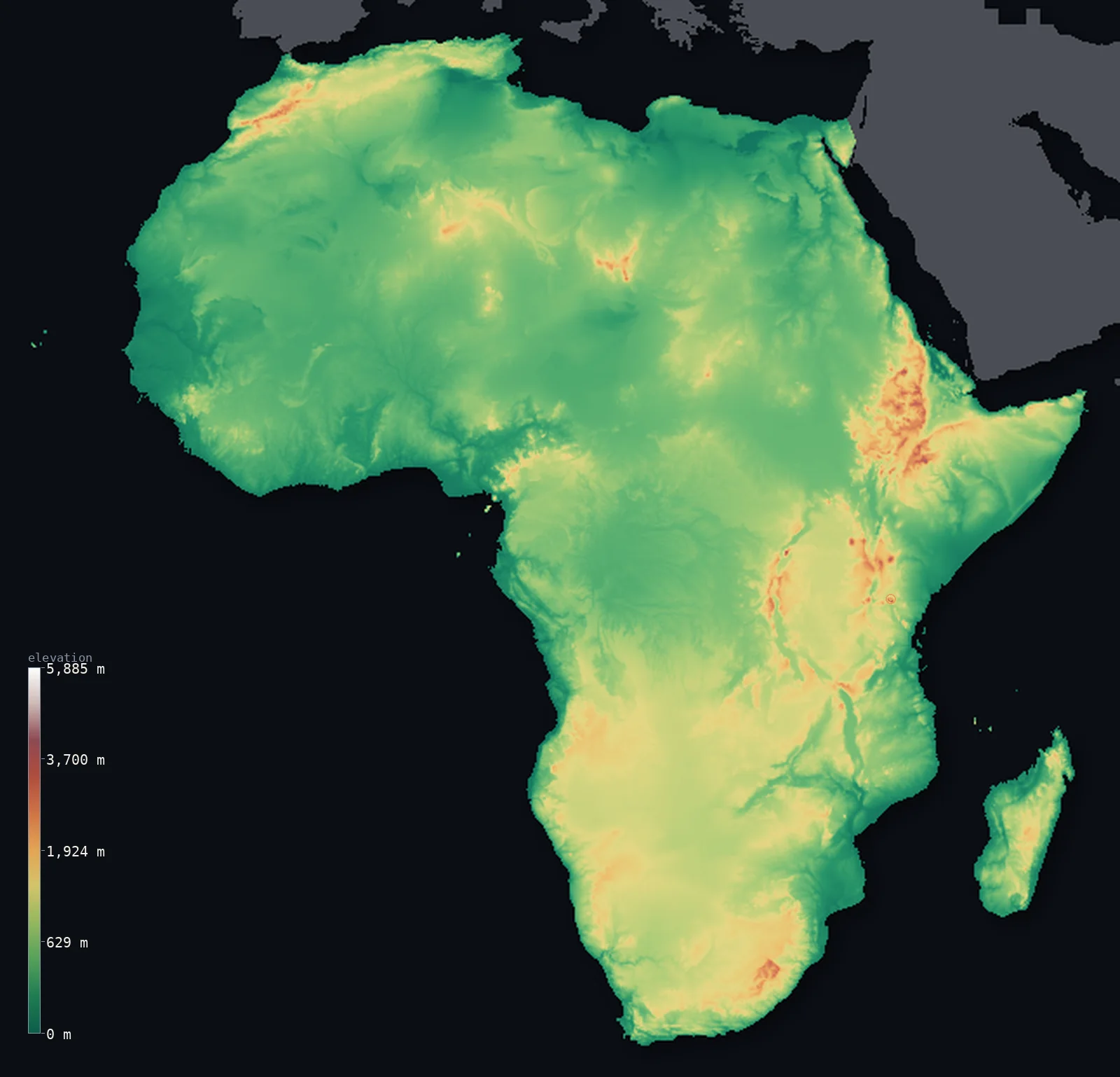
Highest point Mount Kilimanjaro, 5,895 m
Browse
All 7 continents
Ordered by mean elevation — Antarctica’s ice plateau down to the low Oceanian plate. Each card opens that continent’s full 3D map and statistics, and from there every country within it.
- Antarctica
Half its surface lies above 7,644 ft (2,330 m) — higher than its own 7,185 ft (2,190 m) mean — a continent raised onto a thick, high ice sheet, with bare rock climbing higher still to Vinson Massif (Mount Vinson). Only at the thawed margins does the ground fall below the sea — to 164 ft (50 m) at Deep Lake, Vestfold Hills.
- Highest
- Vinson Massif (Mount Vinson) · 16,050 ft (4,892 m)
- Lowest
- Deep Lake, Vestfold Hills · −164 ft (−50 m)
- Mean
- 7,185 ft (2,190 m)
- · Median
- 7,644 ft (2,330 m)
- Asia
Most of it lies low — half below 1,243 ft (379 m) — with the high ground rising to Mount Everest in a narrow minority. Its mean sits at 2,631 ft (802 m), and its lowest land, the Dead Sea shore, lies 1,444 ft (440 m) below sea level.
- Highest
- Mount Everest · 29,032 ft (8,849 m)
- Lowest
- Dead Sea shore · −1,444 ft (−440 m)
- Mean
- 2,631 ft (802 m)
- · Median
- 1,243 ft (379 m)
- North America
Its land ranges 20,591 ft (6,276 m), from the Badwater Basin, Death Valley up to Denali. Half its land lies below 1,283 ft (391 m), and its mean elevation is 2,064 ft (629 m).
- Highest
- Denali · 20,308 ft (6,190 m)
- Lowest
- Badwater Basin, Death Valley · −282 ft (−86 m)
- Mean
- 2,064 ft (629 m)
- · Median
- 1,283 ft (391 m)
- Africa
A high, even tableland — half its land lies above 1,621 ft (494 m), rising to Mount Kilimanjaro. Its mean elevation is 2,054 ft (626 m); its lowest point, Lake Assal, dips 509 ft (155 m) below sea level.
- Highest
- Mount Kilimanjaro · 19,341 ft (5,895 m)
- Lowest
- Lake Assal · −509 ft (−155 m)
- Mean
- 2,054 ft (626 m)
- · Median
- 1,621 ft (494 m)
- South America
Most of it lies low — half below 827 ft (252 m) — with the high ground rising to Aconcagua in a narrow minority. Its mean sits at 1,906 ft (581 m), and its lowest land, Laguna del Carbón, lies 344 ft (105 m) below sea level.
- Highest
- Aconcagua · 22,838 ft (6,961 m)
- Lowest
- Laguna del Carbón · −344 ft (−105 m)
- Mean
- 1,906 ft (581 m)
- · Median
- 827 ft (252 m)
- Europe
Its land ranges 15,804 ft (4,817 m), from Dutch and Danish polders up to Mont Blanc. Half its land lies below 663 ft (202 m), and its mean elevation is 1,161 ft (354 m).
- Highest
- Mont Blanc · 15,781 ft (4,810 m)
- Lowest
- Dutch and Danish polders · −23 ft (−7 m)
- Mean
- 1,161 ft (354 m)
- · Median
- 663 ft (202 m)
- Oceania
Low and flat: half its land sits below 804 ft (245 m), the ground climbing only at its edges to Mount Wilhelm. Its average land lies at just 981 ft (299 m), falling to 49 ft (15 m) below sea level at Lake Eyre, Australia.
- Highest
- Mount Wilhelm · 14,793 ft (4,509 m)
- Lowest
- Lake Eyre, Australia · −49 ft (−15 m)
- Mean
- 981 ft (299 m)
- · Median
- 804 ft (245 m)
Explore the rest
Every country →All 50 US states →The whole world →Home →
Rendered from Copernicus GLO-30 (ESA); boundaries from geoBoundaries. Every figure traces to the elevation model or a sourced dossier.