The Highest Mountain in the World
The answer is Mount Everest — but the word “highest” hides three different questions, and even Everest’s own height wasn’t officially pinned down until 2020.
For nearly two centuries, every new survey gave a slightly different number, and Nepal and China spent decades disagreeing over whether the snow cap should count. Here is the full picture: how tall Everest is, how we know, and why “the biggest mountain” has more than one right answer.
How tall is Mount Everest?
Everest stands 29,031.69 ft (8,848.86 m) above sea level — the highest point on the Earth’s surface. “Above sea level” is the key phrase: it’s an elevation, the height of the ground measured up from the long-run average level of the ocean, not a height in the air (the difference is worth knowing — see elevation vs altitude).
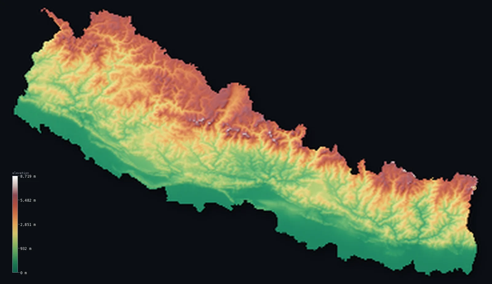
The summit sits on the Nepal–China border, and it is the high point of Nepal — our own maps put it at 8,849 m, rounding the same figure. You can see the peak and the wall of Himalaya around it on the Nepal elevation map.
How Everest was measured — and why the height changed
Everest was first identified as the world’s highest peak in 1847, by the British Great Trigonometrical Survey of India, which knew it only as “Peak XV” and calculated it at 28,799 ft (8,778 m) using theodolites from the plains a hundred miles away. That was remarkably close for the method, but it was the start of a long correction.
A 1950s Survey of India remeasurement produced 29,029 ft (8,848 m), the figure that stood in atlases for half a century. In 1999 an American team carried GPS receivers to the summit and got 29,035 ft (8,850 m), snow cap included. Then in 2005 China measured the rock head beneath the snow and reported 29,017 ft (8,844.43 m) — and that gap, snow versus rock, became a genuine diplomatic dispute.
China argued the mountain’s true height was the rock; Nepal held that the snow and ice on top are part of Everest and should count. The two countries finally surveyed it together, and in December 2020 announced a single agreed figure — 8,848.86 m, snow included — about 86 cm (2.8 ft) above the old 8,848 m. It was less a discovery than a treaty: the first Everest height both nations signed off on, and the reason the number is now settled.
Is Everest really the tallest? Highest vs tallest vs farthest
Everest is the highest — but not, strictly, the tallest, and not the point farthest from the Earth’s centre. Those are three different superlatives, and three different mountains win them.
Tallest, base to peak, is Hawaii’s Mauna Kea. Its summit reaches only 13,796 ft (4,205 m) of elevation, but its base sits on the ocean floor, and from there it stands about 33,497 ft (10,210 m) — taller than Everest, with most of it underwater (per NOAA). This is the same highest-versus-tallest distinction covered in elevation vs altitude.
Farthest from the Earth’s centre is Ecuador’s Chimborazo. The Earth isn’t a perfect sphere — it bulges at the equator, where sea level sits about 21 km farther from the core than at the poles. Chimborazo stands almost on the equator, so even though its summit is only 20,548 ft (6,263 m) in elevation, riding that bulge carries it roughly 6,798 ft (2,072 m) farther from the planet’s centre than Everest’s summit — making it, per NOAA, the point on Earth’s surface closest to space.
Where is Everest, and why are the highest mountains here?
Everest sits in the Himalaya, on the Nepal–China (Tibet) border, and it has plenty of company: of the fourteen peaks on Earth above 8,000 m, all fourteen are in the Himalaya and the neighbouring Karakoram. That concentration isn’t a coincidence — it’s the signature of the biggest mountain-building event on the planet.
Around 50 million years ago the Indian plate collided with Eurasia and kept pushing north, crumpling the crust between them upward. The Himalaya is still rising a few millimetres a year as that collision continues, which is part of why Everest’s height is worth re-measuring at all. You can see the whole range in relief across the most mountainous countries.
The world’s highest mountains
Everest leads the fourteen “eight-thousanders,” the only mountains above 8,000 m. Here are the top ten by height; the full ranked table, with each peak located and profiled, is in our 10 highest mountains guide.
- 1Mount Everest · Nepal / China29,032 ft (8,848.86 m)
- 2K2 · Pakistan / China28,251 ft (8,611 m)
- 3Kangchenjunga · Nepal / India28,169 ft (8,586 m)
- 4Lhotse · Nepal / China27,940 ft (8,516 m)
- 5Makalu · Nepal / China27,838 ft (8,485 m)
- 6Cho Oyu · Nepal / China26,864 ft (8,188 m)
- 7Dhaulagiri I · Nepal26,795 ft (8,167 m)
- 8Manaslu · Nepal26,781 ft (8,163 m)
- 9Nanga Parbat · Pakistan26,660 ft (8,126 m)
- 10Annapurna I · Nepal26,545 ft (8,091 m)
Second place goes to K2 at 28,251 ft (8,611 m), on the Pakistan–China border in the Karakoram — lower than Everest but widely considered a harder, deadlier climb. Everything below the top few is separated by tens of metres, which is exactly why precise, consistent measurement matters.
Climbing Everest and the death zone
Above about 8,000 m lies what climbers call the death zone — where the air holds so little oxygen that the human body cannot acclimatise and slowly shuts down, no matter how fit you are. Everest’s summit is nearly 850 m into it, which is why most climbers use bottled oxygen and why time at the top is measured in minutes.
Hundreds have died on Everest since the first ascent in 1953, from altitude, cold, avalanche and exhaustion, and many bodies remain on the mountain. It is the highest point a person can stand on Earth, and reaching it is as much a physiological limit as a mountaineering one.
See Everest in 3D
Everest is the high point of Nepal, and our maps render the whole Himalayan wall around it as real 3D terrain from satellite data. Explore the Nepal elevation map, or browse the full country index.
Frequently asked questions
- What is the highest mountain in the world?
- Mount Everest, at 29,031.69 ft (8,848.86 m) above sea level, on the Nepal–China border. Its height was jointly confirmed by Nepal and China in 2020.
- How tall is Mount Everest?
- 8,848.86 m — 29,031.69 ft — above sea level, as of the 2020 joint Nepal-China survey. That includes the snow cap; the rock beneath is about 4 m lower.
- Is Everest the tallest mountain?
- It’s the highest above sea level. Measured base to peak, Hawaii’s Mauna Kea is taller — about 10,210 m, most of it underwater. And Ecuador’s Chimborazo is the point farthest from the Earth’s centre, thanks to the equatorial bulge.
- Why did Everest’s height change?
- Because measurement improved and the definition was disputed. Surveys ran from 8,778 m (1847) to 8,848 m (1950s) to 8,850 m (1999, GPS); China measured the rock at 8,844.43 m in 2005; the 2020 joint survey settled on 8,848.86 m, snow included.
- Where is Mount Everest?
- In the Himalaya, on the border between Nepal and the Tibet region of China. It is the highest point of Nepal, and the Himalayan wall around it is worth seeing in relief.
- What is the second-highest mountain?
- K2, at 28,251 ft (8,611 m), on the Pakistan–China border in the Karakoram — lower than Everest but considered a more dangerous climb.
Sources
Everest’s official height, the 2020 joint Nepal-China survey and the snow-versus-rock history are reported by the Kathmandu Post; the same 8,849 m figure is the high point on our Nepal map. Mauna Kea’s ~10,210 m base-to-peak height and Chimborazo’s status as the point farthest from Earth’s centre are both from NOAA, whose National Ocean Service sets all three records side by side; Chimborazo’s 6,263 m elevation is our Ecuador dossier value (NOAA’s survey gives ~6,268 m). How this site measures elevation is on the methodology page. Built by Marko Visic.
Related
- · The 10 highest mountains — the full ranked list, to scale, with all 14 eight-thousanders.
- · The lowest point on Earth — the opposite extreme: Challenger Deep, deeper than Everest is tall.
- · Elevation vs altitude — highest vs tallest, and what “above sea level” means.
- · Most mountainous countries — the ranges that hold the eight-thousanders.
- · Highest capital cities — the highest places people actually live.
- · More elevation deep-dives — the blog.
Everest height and measurement history: 2020 joint Nepal-China survey (via the Kathmandu Post); Everest and Chimborazo elevations from our dossiers (Copernicus GLO-30, ESA); Mauna Kea base-to-peak from NOAA. Built by Marko Visic.