Elevation vs Altitude
People use “elevation” and “altitude” as if they were the same word, and even reference sites disagree on whether that’s fine. Some call them interchangeable; others insist they’re strictly different.
Both camps are half right, which is why the confusion sticks. In everyday speech the two overlap; in the places where the difference actually bites — aviation, mountaineering, how your body feels the thin air — they are not the same thing at all.
Here is the clear version: what each word means, the one insight that separates them for good, and how the whole family — elevation, altitude, height and depth — fits together.
Elevation: height of the ground
Elevation is the height of a fixed point on the ground, measured up from mean sea level — the long-run average level of the ocean, used as the zero line for heights on land. When a map says Denver is a mile high or a summit is 4,000 m, that is elevation.
The defining feature is that it doesn’t change. A mountain’s elevation is a property of the rock, not the weather or the day. It’s what topographic maps record, what surveyors mark on benchmarks, and what this site measures for every country and state — the height of the land itself.
Altitude: height in the air
Altitude is height measured to something in the air, above a reference. In everyday use that reference is usually sea level again — a plane at “35,000 feet” is 35,000 feet above the sea. The difference from elevation is what you’re measuring up to: not a point on the ground, but a point in the sky.
Aviation, where the word earns its keep, actually tracks several altitudes at once. Height above the ground directly below is one; height above sea level is another; and pressure altitude — height as read from air pressure — is a third. That last one is where elevation and altitude finally part ways.
Why altitude can change when elevation can’t
Here is the insight almost no one leads with. An altimeter doesn’t measure height with a ruler — it reads air pressure, which falls as you go up, and converts it to a height. But air pressure at a given spot isn’t constant: a high-pressure day is “heavier,” a storm system is lighter. So the pressure altitude of a fixed place drifts up and down with the weather.
Say you climb a 14,000-foot peak. Its elevation is nailed to the rock. But as a low-pressure storm moves in, the air thins, and the pressure altitude your body and your instruments read climbs — the same summit now behaves like a 15,000-foot one.
You didn’t move; the atmosphere did. That is the crux: elevation is fixed to the ground, altitude is tied to the air, and the air changes.
It isn’t only an aviation quirk. Thinner air holds less oxygen, so the “effective” altitude your lungs experience rises on a low-pressure day too — part of why high mountains feel harder in bad weather.
Are elevation and altitude the same thing?
Colloquially, often yes; technically, no. If you say a town sits “at high altitude” when you mean its ground is high above sea level, no one will misunderstand you — everyday English lets the words overlap, and dictionaries list them as near-synonyms.
The distinction matters the moment something is in the air or changing. A pilot, a balloonist, a meteorologist or a mountaineer needs to know whether a number is fixed to the ground (elevation) or floating in the atmosphere (altitude) — because only one of them moves. That is the honest resolution to a question the search results can’t seem to agree on: interchangeable in casual use, distinct wherever precision counts.
Height and depth: the full family
Two more words round out the set. Height is the vertical distance from the base of a thing to its top — a building’s height, or a mountain’s from foot to peak. Depth is the distance below a surface, or below sea level — a negative elevation, like the shore of the Dead Sea or a Dutch polder (see countries below sea level).
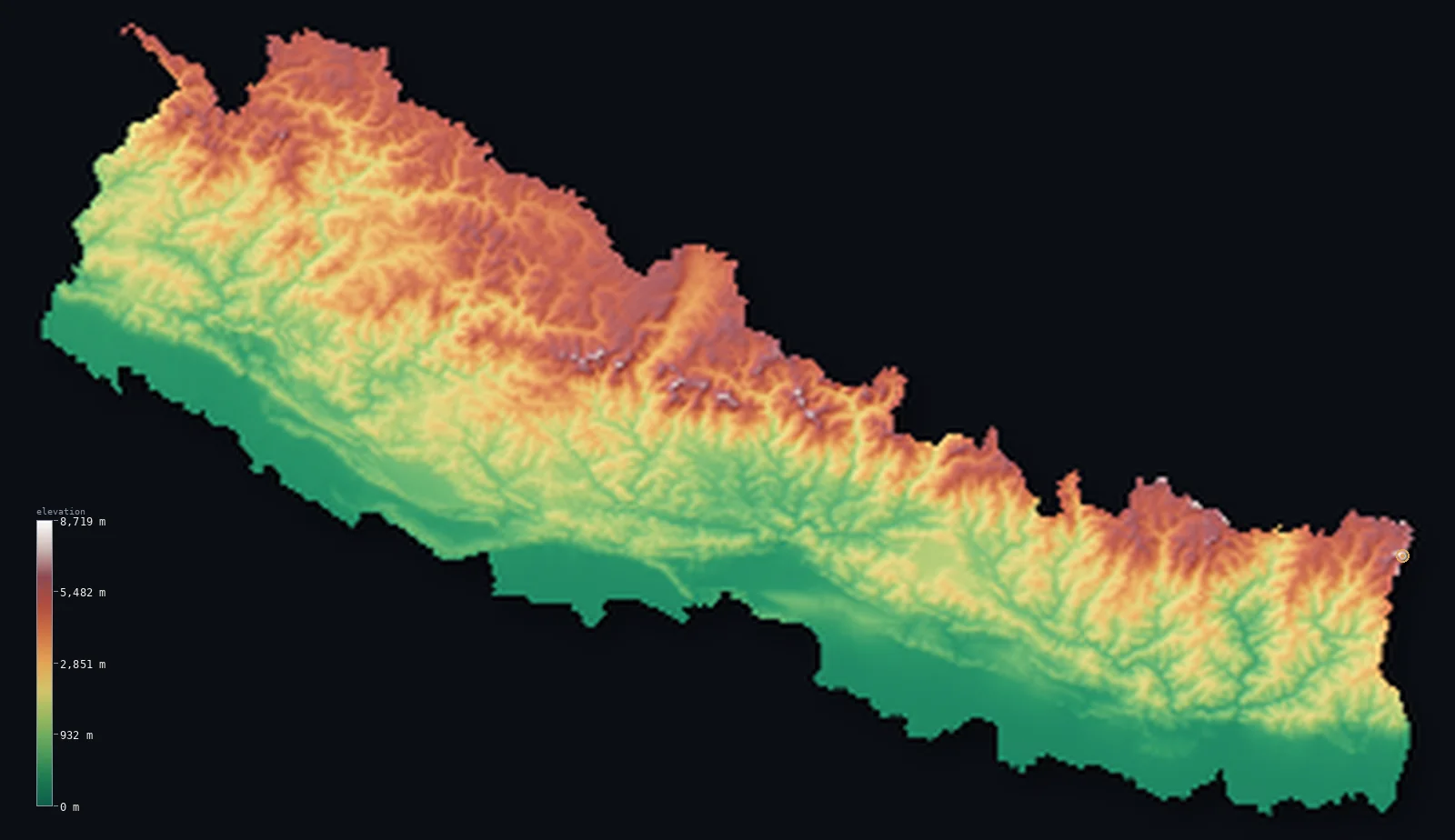
Elevation and height are the pair most often mixed up, and the sharpest illustration is which mountain is “biggest.” By elevation, Mount Everest wins: its summit is 29,032 ft (8,849 m) above sea level, the highest point on Earth (our own maps put it there — see Nepal). But by height, base to peak, the title goes to Hawaii’s Mauna Kea.
Mauna Kea’s summit reaches just 13,796 ft (4,205 m) of elevation, far below Everest. But most of the mountain is underwater: measured from its base on the sea floor, it stands about 33,497 ft (10,210 m) tall. Highest is an elevation question; tallest is a height question — and they have different answers.
What counts as high altitude?
“High altitude” has a rough working threshold: ground above about 8,000 ft (2,400 m) is where the thin air starts to affect healthy visitors, and where altitude sickness becomes a real risk for people arriving quickly from lower down. It’s the band that many mountain resorts and a handful of capital cities sit in.
Note the wording: it’s about how high the ground is, so this is really an elevation threshold wearing the word “altitude” — exactly the casual overlap from earlier. If you want the cities that live up there, our highest capital cities ranking runs from La Paz down, with the top three above that line.
Which does elevation data measure?
Elevation. Every figure on this site is the height of the ground above mean sea level, sampled from a satellite model of the Earth’s surface — fixed values for fixed places, never an altitude in the air. When we say a country’s mean elevation, or a peak’s height above the sea, that is elevation in the strict sense.
It’s worth knowing which one you’re reading. A topographic map, a survey benchmark and this site all deal in elevation; an altimeter, a flight level and a weather balloon all deal in altitude. Same units, different questions.
Highest vs tallest: Everest is highest by elevation (29,032 ft / 8,849 m above sea level); Mauna Kea is tallest by height (~33,497 ft / 10,210 m base to peak, per NOAA).
“High altitude” begins around 8,000 ft (2,400 m) of ground elevation — where thin air starts to be felt.
See elevation on the map
Our maps show elevation — the height of the ground above sea level — for every country and US state, rendered as real 3D terrain from satellite data. Browse the country index, or see how nations compare in average elevation by country and most mountainous countries.
Frequently asked questions
- What is the difference between elevation and altitude?
- Elevation is how high a fixed point on the ground is above mean sea level, and it doesn’t change. Altitude is how high something is in the air above a reference, and it can — including with air pressure.
- Are elevation and altitude interchangeable?
- In casual speech, usually — dictionaries treat them as near-synonyms. In aviation, weather and mountaineering they are not: there it matters whether a height is fixed to the ground or floating in the atmosphere.
- Is a mountain’s height its elevation or its altitude?
- Its elevation — the height of its summit above sea level. “Altitude” better describes something in the air above the mountain, like a plane. And its base-to-peak “height” is a third figure again: Mauna Kea is Earth’s tallest by height but not by elevation.
- What counts as high altitude?
- Roughly ground above 8,000 ft (2,400 m), where thin air starts to affect visitors and altitude sickness becomes a risk for people arriving quickly from lower elevations.
- Does elevation change over time?
- Essentially no, on human timescales — a place’s elevation is fixed (tectonics shifts it only over geological ages). That’s the whole contrast with altitude, which can change day to day with the weather.
- Elevation vs altitude vs height — what’s the difference?
- Elevation is ground-above-sea-level (fixed); altitude is in-the-air-above-a-reference (can change); height is base-to-top of a thing. Depth is the fourth: below a surface or below sea level.
Sources
The definitions here follow standard usage in surveying and aviation; the US Geological Survey sets out the elevation-versus-altitude distinction, and pressure altitude is a core aviation concept. The highest-versus-tallest figures: Everest at 8,849 m and Mauna Kea’s summit at 4,205 m are our own dossier values (rendered on the Nepal map and elsewhere); Mauna Kea’s ~10,210 m base-to-peak height is from NOAA. How this site measures elevation — the median ground height from Copernicus GLO-30 — is described on the methodology page. Built by Marko Visic.
Related
- · The highest mountain in the world — Everest, and the highest-vs-tallest question in full.
- · Highest capital cities — the “high altitude” capitals, measured by elevation.
- · Most mountainous countries — relief and high terrain.
- · Countries below sea level — where elevation goes negative (depth).
- · More elevation deep-dives — the blog.
Everest and Mauna Kea summit elevations from our dossiers (Copernicus GLO-30, ESA); Mauna Kea base-to-peak height from NOAA. Definitions per USGS / standard aviation usage. Built by Marko Visic.