Samoa Elevation Map — Topographic & 3D Terrain
Explore the terrain of Samoa in interactive 3D, built from Copernicus GLO-30 satellite elevation data — two main volcanic islands rising to forested mountain spines. Drag to rotate, scroll to zoom, and tap any point to read its elevation.
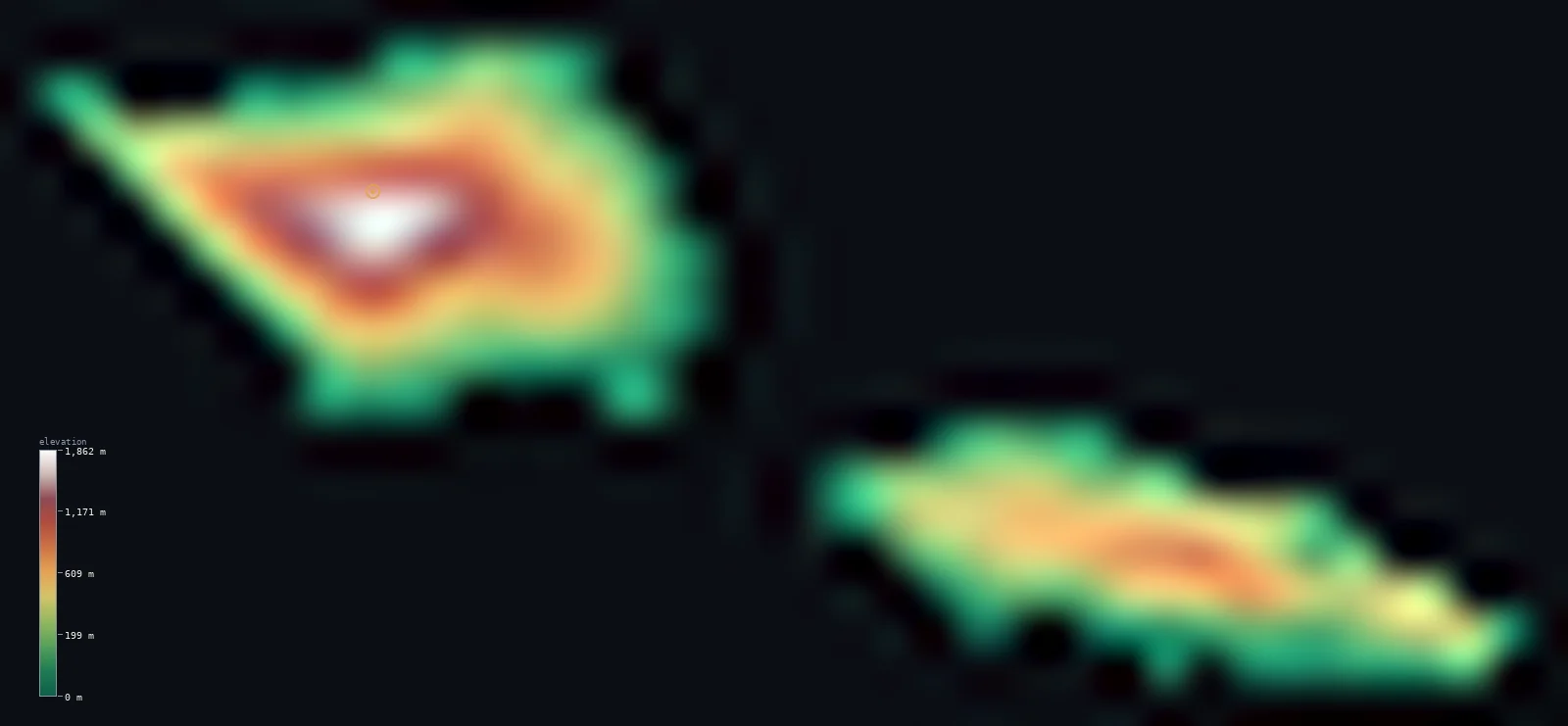
Samoa’s highest point is Mount Silisili at 6,096 ft (1,858 m); its lowest is Pacific Ocean at 0 ft (0 m); the mean elevation is 1,217 ft (371 m).
Samoa is built from volcanoes. Its two main islands — Savai'i and Upolu — are shield volcanoes rising from the central South Pacific, each with a forested mountain spine down its length, and Savai'i in particular is geologically young — its Matavanu vent erupted between 1905 and 1911. The land climbs steeply from the coast: more than half of Samoa stands above 656 ft (200 m), and its highest point, Mount Silisili on Savai'i, reaches 6,096 ft (1,858 m).
- Highest point📚
- 6,096 ft1,858 m
- Samoa's highest point is Mount Silisili at 6,096 ft (1,858 m), on Savai'i — the summit of the larger, higher, and more volcanically active of Samoa's two main islands, standing above a forested highland interior.
- Lowest point📚
- 0 ft0 m
- Samoa's lowest point is the Pacific at sea level, around the coasts of its islands — a shoreline of coral reef, lava rock, and black volcanic sand, backed by the coastal flats where most Samoans live.
- Mean elevation⚙
- 1,217 ft371 m
- Samoa's mean elevation computed from the GLO-30 model is 1,217 ft (371 m) — high for a Pacific island nation, because Samoa's islands are shield volcanoes that rise steeply to mountainous interiors rather than low atolls.
- Median elevation⚙
- 833 ft254 m
- Half of Samoa lies below 833 ft (254 m) — below the mean, the mark of islands that climb sharply from the coast: a large share of steep interior high ground set against the coastal lowlands and the villages ringing the shore.
- Elevation range📚
- 6,096 ft1,858 m
- From the sea to the summit of Mount Silisili, Samoa spans about 6,100 ft — most of it on Savai'i, whose volcanic dome rises higher than neighbouring Upolu.
- Above 1,000 m (3,281 ft)⚙
- 9%
- About 9% of Samoa rises above 1,000 m (3,281 ft) — the high interiors of Savai'i and, lower, Upolu, forested volcanic highlands above the coastal settlements.
- Official area📚
- 1,097 mi²2,842 km²
- Samoa covers about 1,100 sq mi (2,842 sq km) across two main islands, Savai'i and Upolu, and several smaller ones, in the central South Pacific.
- Forest cover📚
- 60.4%
- About 60.4% of Samoa is forested — dense tropical rainforest over the volcanic interiors of both main islands, giving way to plantation and village land along the coasts.
Highest and lowest points
Samoa's highest point is Mount Silisili, 6,096 ft (1,858 m), the summit of Savai'i — the larger and higher of Samoa's two main islands, and one of the youngest volcanic landscapes in the Pacific. Savai'i is a shield volcano whose Matavanu vent erupted between 1905 and 1911, when lava flows reached the coast and buried villages; Silisili crowns its forested highland interior. Upolu, the other main island and the site of the capital, Apia, rises to a lower spine along its length.
source ↗Samoa's lowest point is the Pacific at sea level, around the coasts of its islands. Most Samoans live on this coastal fringe — the flatter ground where the volcanic slopes meet the sea, ringed by coral reef and, on Savai'i especially, by fields of black lava from past eruptions. The interiors rise steeply behind, forested and thinly settled, so the country's life is concentrated on the narrow band between the mountains and the water.
source ↗Samoa at a glance
Samoa's highest point, Mount Silisili (1,858 m), is the summit of Savai'i, a shield volcano and one of the youngest volcanic landscapes in the Pacific.
source ↗Savai'i is still volcanically active - eruptions from Matavanu between 1905 and 1911 buried villages under lava that reached the sea.
source ↗Samoa's two main islands, Savai'i and Upolu, are both shield volcanoes with forested mountain spines running their length.
source ↗More than half of Samoa's land stands above 200 m - the islands rise steeply from the coast rather than lying low like coral atolls.
source ↗Most Samoans live on the coastal flats, where the volcanic slopes meet the sea, while the forested interiors are thinly settled.
source ↗The capital, Apia, lies on the north coast of Upolu, the more populous of the two main islands though not the higher.
source ↗Mount Silisili (1,858 m), Samoa's highest point, is one of the highest peaks in all of Polynesia.
source ↗The whole archipelago was built by the Samoa hotspot, a volcanic plume beneath the Pacific plate.
source ↗Savai'i and Upolu are among the largest islands in Polynesia, after only New Zealand and Hawaii.
source ↗
Elevation profile of Samoa
The largest share of land, 45%, falls in the 0–200 m band, and 71% of the territory lies below 500 m (1,640 ft).
- below 500 m (1,640 ft)71%
- 500–1,000 m20%
- 1,000–2,000 m9%
Highest peaks of Samoa
Two volcanic islands, and the isles between
Savai'i
The larger, higher, and more volcanically active island — a shield volcano rising to Mount Silisili, its highest point, with a forested and thinly populated interior. Savai'i's youth shows in its lava fields, some from eruptions barely a century old, reaching down to the coast.
Upolu
The more populous island, holding the capital Apia on its north coast, rises to a lower forested spine along its length — a smaller shield volcano than Savai'i, and the centre of Samoan life.
The strait and smaller islands
Between and around the two main islands lie several smaller ones, including Manono and Apolima in the strait that separates them — low, reef-fringed volcanic isles, thinly settled.
How to read this map
Color shows elevation; the raised relief shows real terrain. On this map Samoa reads as two green volcanic islands, each rising to a brown forested spine, with the higher ground on Savai'i to the west.
The 3D relief is the actual GLO-30 elevation data, exaggerated vertically so the islands' steep rise from the sea shows; the ×N relief slider controls how much. Tap anywhere to read that point's exact elevation.
City elevations in Samoa
Samoa's main town is Apia, on the north coast of Upolu at sea level - the capital and by far the largest settlement. Most other villages ring the coasts of the two islands, close to the sea beneath the volcanic interiors.
| City | Population | Elevation |
|---|---|---|
| Apiacapitalthe capital, on the north coast of Upolu at sea level, the country's main town and port ↗ | 40,407 | 13 ft4 m |
| Palauli | 9,300 | 23 ft7 m |
| Asau | 6,643 | 33 ft10 m |
| Mulifanua | 4,508 | 23 ft7 m |
| Falefa | 1,707 | 30 ft9 m |
| Matavai | 1,308 | 56 ft17 m |
| Safotu | 1,207 | 33 ft10 m |
| Lotofagā | 1,126 | 36 ft11 m |
| Safotulafai | 0 | 13 ft4 m |
Elevation sampled at each city centre from the Copernicus GLO-30 model. Cities and population from GeoNames (CC-BY 4.0).
Samoa in comparison
Samoa's terrain rises 6,096 ft (1,858 m) from sea level to Mount Silisili — about 21% of the height of Mount Everest, the world's highest point at 29,032 ft (8,849 m).
- Tonga's mean elevation is 176 ft — 1,041 ft lower; its high point, Kao, reaches 3,389 ft (1,033 m), 2,707 ft below. Tonga elevation map →
- Fiji's mean elevation is 669 ft — 548 ft lower; its high point, Mount Tomanivi (Mount Victoria), reaches 4,344 ft (1,324 m), 1,752 ft below. Fiji elevation map →
- Vanuatu's mean elevation is 899 ft — 318 ft lower; its high point, Mount Tabwemasana, reaches 6,165 ft (1,879 m), 69 ft above. Vanuatu elevation map →
Frequently asked questions
What is the highest point in Samoa?
- Mount Silisili, 6,096 ft (1,858 m), the summit of Savai'i, the larger of Samoa's two main islands.
What is the lowest point in Samoa?
- Sea level, around the coasts of its islands.
What is the average elevation of Samoa?
- Computed from the Copernicus GLO-30 model, the area-weighted mean is 1,217 ft (371 m) - high for a Pacific nation, because Samoa's islands are shield volcanoes with mountainous interiors, not low atolls.
Is Samoa volcanic?
- Yes - both main islands are shield volcanoes, and Savai'i's Matavanu vent erupted between 1905 and 1911, with lava flows reaching the coast.
What are Samoa's two main islands?
- Savai'i, the larger and higher, carrying Mount Silisili; and Upolu, the more populous, holding the capital Apia.
Is this a topographic, relief, contour, or elevation map of Samoa?
- They describe the same thing - terrain height. This page renders the country's actual elevation surface in interactive 3D and reports the statistics computed from it.
About this map
The terrain is rendered from the Copernicus GLO-30 digital elevation model (ESA), masked to the WSM-ADM0 boundary from geoBoundaries (gbOpen). Elevation statistics are computed directly from the model; peak names and researched facts are sourced and cited. See the methodology for the full pipeline.
Our area-weighted mean, computed from the Copernicus GLO-30 model, is 1,217 ft (371 m); no authority publishes a mean elevation (No authoritative published mean elevation). No standard source publishes a single mean elevation for Samoa; the islands rise from sea level to 1,858 m, with rugged volcanic interiors and narrow coastal plains. The page reports the area-weighted mean computed from the Copernicus GLO-30 model over the rendered land.
Surveyed national figures: official area · forest cover · high point.
Rendered from Copernicus GLO-30 (ESA, 2021 release), boundaries from geoBoundaries. Generated 2026-07-25.