The Bahamas Elevation Map
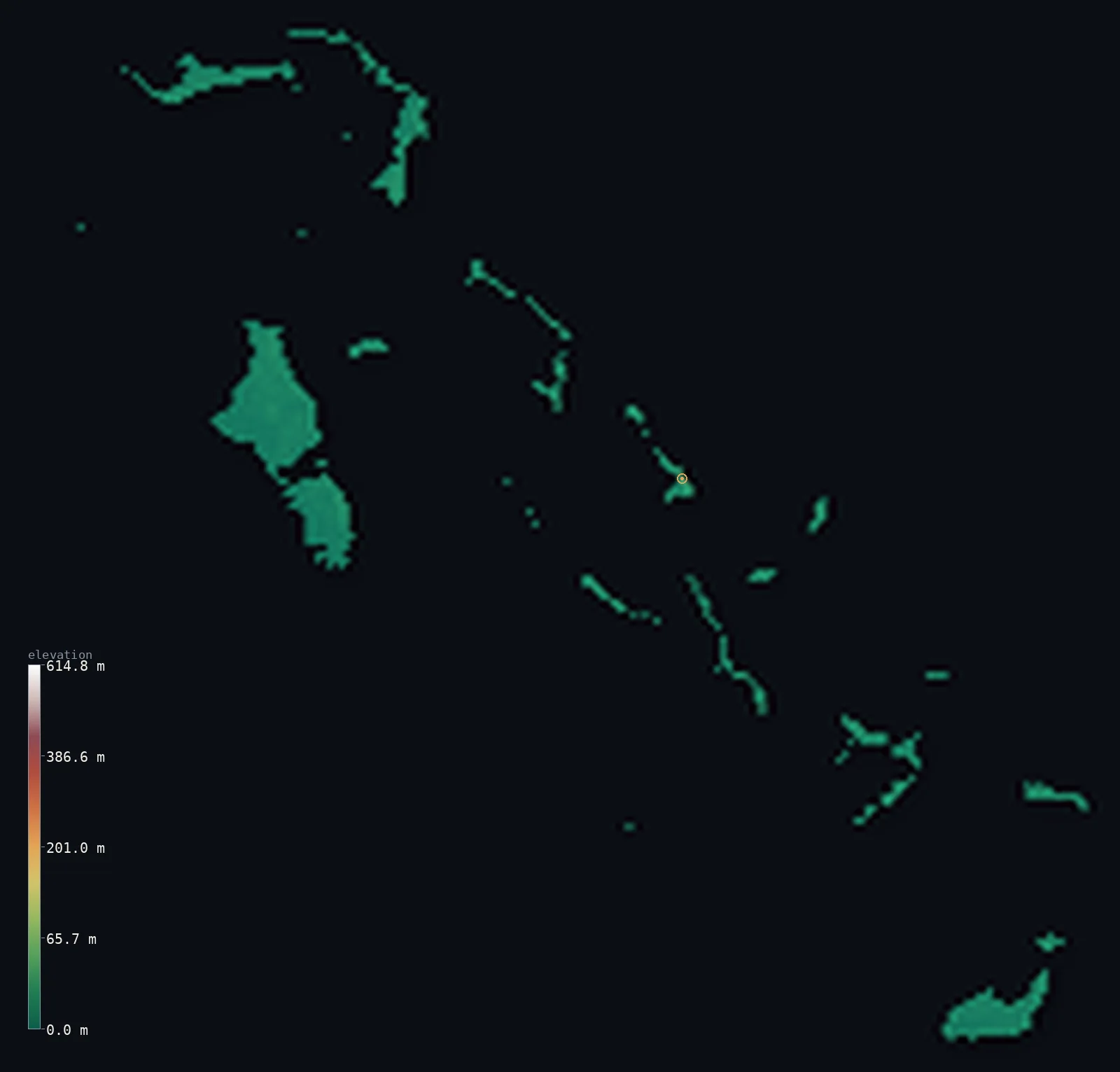
The Bahamas’s highest point is Mount Alvernia (Como Hill) at 207 ft (63 m); its lowest is Atlantic Ocean at 0 ft (0 m); the mean elevation is 8 ft (2.3 m).
- Highest point📚
- 207 ft63 m
- Mount Alvernia (Como Hill) on Cat Island — a 63 m limestone hill, the archipelago's high point.
- Lowest point📚
- 0 ft0 m
- Sea level across this very low-lying island chain.
- Mean elevation⚙
- 8 ft2.3 m
- Computed from the GLO-30 surface model across the islands.
- Median elevation⚙
- 6 ft1.8 m
- Half of The Bahamas lies below this height.
- Elevation range📚
- 207 ft63 m
- From sea level to Mount Alvernia's 63 m — one of the smallest elevation ranges of any country.
- Above 50 m (164 ft)⚙
- 0%
- Cat Island's low limestone ridge, the only ground above ~40 m.
- Official area📚
- 5,358 mi²13,878 km²
- An archipelago of ~700 low coral and limestone islands and cays in the western Atlantic.
- Forest cover📚
- 50.9%
- About half the land is wooded — pine forest on the northern islands, low scrub and mangrove elsewhere.
Highest and lowest points
A low limestone hill on Cat Island, just 63 m (207 ft) above sea level — yet the highest point in the entire Bahamas, an archipelago of around 700 low coral and limestone islands. Locally called Como Hill; renamed Mount Alvernia by the priest-architect John Hawes, who built the stone Hermitage on its summit in 1939. It is one of the lowest national high points on Earth.
source ↗Mount Alvernia (Como Hill)'s surveyed summit sits just outside the generalized The Bahamas boundary, so the highest fully in-territory land pixel in the model is 215 ft (65.6 m). The headline figure above is the surveyed elevation of the recognised national high point.
The Bahamas at a glance
The highest point in the entire Bahamas is just 63 m — Mount Alvernia on Cat Island — one of the lowest national high points anywhere on Earth.
source ↗The whole country is the exposed top of two giant limestone banks — the Little and Great Bahama Banks — so the islands are essentially flat platforms barely above the sea.
source ↗New Providence, the island with the capital Nassau, reaches a maximum of only about 37 m above sea level.
source ↗The Bahamas spans roughly 700 islands and cays, but only 30 to 40 are inhabited; Andros, the largest, holds the country's only river.
source ↗The country's high point is crowned by the Hermitage — a tiny medieval-style stone monastery built by hand in 1939 by the priest-architect John Hawes, who lived there as a hermit.
source ↗Christopher Columbus is generally thought to have made his first New World landfall in 1492 on San Salvador, one of the central Bahamian islands.
source ↗The low islands are pocked with 'blue holes' — flooded sinkholes and caves; Dean's Blue Hole off Long Island plunges to about 200 m, among the deepest in the world.
source ↗
Elevation profile of The Bahamas
The largest share of land, 53%, falls in the 0–2 m band, and 100% of the territory lies below 500 m (1,640 ft).
- 0–10 m (0–33 ft)99%
- 10–50 m (33–164 ft)1%
Highest peaks of The Bahamas
| Peak | Elevation | Range | Note |
|---|---|---|---|
| Mount Alvernia (Como Hill)↗ | 207 ft63 m | Cat Island | Highest point of the Bahamas, a limestone hill on Cat Island topped by the 1939 Hermitage monastery. |
| Eleuthera high ground↗ | 167 ft51 m | Eleuthera | Eleuthera and Long Island have the greatest number of hills exceeding 30 m in the Bahamas. |
| New Providence high point↗ | 121 ft37 m | New Providence | The highest ground on the island that holds the capital, Nassau — only about 37 m above the sea. |
Terrain regions of The Bahamas
The highest point in the entire Bahamas is just 63 m — Mount Alvernia on Cat Island — one of the lowest national high points anywhere on Earth. ↗
Northern islands
↗Grand Bahama, the Abacos, Bimini, Andros and New Providence — the larger, more populated, pine-forested northern islands, including the capital Nassau and the city of Freeport.
Central islands
↗Eleuthera, Cat Island, San Salvador and the Exumas — the central chain, holding the country's high point (Mount Alvernia on Cat Island) and the landfall island of San Salvador.
Southern islands
↗Acklins, Crooked Island, Mayaguana and Great Inagua — the remote, drier southern islands; Great Inagua is the second-largest and famed for its flamingos and salt ponds.
The Bahama Banks (low limestone platform)
all islandsThe whole country is the exposed surface of two vast shallow carbonate platforms — the Little Bahama Bank and the Great Bahama Bank — built of oolitic limestone and fossil coral. The land barely rises above the sea: flat, rocky or swampy, with thin soils and low scrub, fringed by reefs and turquoise shallows.
Cat Island ridge (the high point)
Cat IslandCat Island carries the country's only real hill — Mount Alvernia / Como Hill at 63 m — a low limestone rise topped by the hand-built Hermitage and overlooking an eight-mile pink-sand beach.
Pine forests, mangroves and blue holes
northern and central islandsPine forest covers four northern islands (Grand Bahama, Abaco, New Providence, Andros); elsewhere low tropical hardwood, scrub and mangrove dominate. The islands are riddled with blue holes and caves — Dean's Blue Hole off Long Island is one of the world's deepest.
Inland waters and salt ponds
scatteredThe islands hold few freshwater bodies — only one true river, on Andros — but many lakes, creeks and tidal ponds, including Lake Rosa on Great Inagua, ringed by salt flats and one of the largest flamingo colonies in the world.
City elevations in The Bahamas
| City | Population | Elevation |
|---|---|---|
| NassaucapitalNassau, the capital, sits on New Providence — an island whose highest point is only about 37 m — so the city and nearly all its surroundings lie just a few metres above the sea. ↗ | 227,940 | 10 ft3 m |
| Lucaya | 46,525 | 13 ft4 m |
| Cooper’s Town | 8,413 | 23 ft7 m |
| San Andros | 7,800 | 20 ft6 m |
| George Town | 7,314 | 33 ft10 m |
| Freetown | 3,137 | 10 ft3 m |
| Clarence Town | 1,752 | 36 ft11 m |
| Arthur’s Town | 1,175 | 16 ft5 m |
| Alice Town | 949 | 33 ft10 m |
| Cockburn Town | 831 | 16 ft5 m |
Elevation sampled at each city centre from the Copernicus GLO-30 model. Cities and population from GeoNames (CC-BY 4.0).
The Bahamas in comparison
The Bahamas's terrain rises 207 ft (63 m) from sea level to Mount Alvernia (Como Hill) — about 1% of the height of Mount Everest, the world's highest point at 29,032 ft (8,849 m).
- Antigua and Barbuda's mean elevation is 91 ft — 83 ft higher; its high point, Boggy Peak (Mount Obama), reaches 1,319 ft (402 m), 1,112 ft above. Antigua and Barbuda elevation map →
- Barbados's mean elevation is 341 ft — 334 ft higher; its high point, Mount Hillaby, reaches 1,115 ft (340 m), 909 ft above. Barbados elevation map →
- Cuba's mean elevation is 320 ft — 313 ft higher; its high point, Pico Turquino, reaches 6,476 ft (1,974 m), 6,270 ft above. Cuba elevation map →
Frequently asked questions
What is the highest point in the Bahamas?
- Mount Alvernia, locally called Como Hill, on Cat Island — just 207 ft (63 m), yet the highest point in the whole archipelago and one of the lowest national high points on Earth.
Why is the Bahamas so flat?
- Because the islands are the exposed surface of two vast, shallow limestone banks built from coral and oolitic limestone — there are no mountains, and the highest ground is only 63 m above the sea.
What is the average elevation of the Bahamas?
- Computed from the Copernicus GLO-30 model, the area-weighted mean is 8 ft (2.3 m). The Bahamas is one of the lowest-lying countries in the world, with its highest point only 63 m above sea level.
How many islands are in the Bahamas?
- Around 700 islands and cays, of which only 30 to 40 are inhabited. Andros is the largest, and New Providence holds the capital, Nassau.
What is Mount Alvernia's Hermitage?
- A small medieval-style stone monastery built by hand in 1939 by the priest-architect John Hawes (Father Jerome) on the summit of the country's high point, where he lived as a hermit until 1956.
Does the Bahamas have any rivers?
- Almost none — the porous limestone holds little surface water. There is just one true river, on Andros Island, alongside many lakes, tidal creeks and flooded 'blue holes'.
Where did Columbus land in the Bahamas?
- Columbus is generally believed to have made his first New World landfall in 1492 on San Salvador, one of the central Bahamian islands.
Is this a topographic, relief, contour, or elevation map of the Bahamas?
- They describe the same thing — terrain height. This page renders the Bahamas' actual elevation surface in interactive 3D (a relief or topographic view) and reports the elevation statistics computed from it; a contour map shows the same data as lines of equal height.
About this map
The terrain is rendered from the Copernicus GLO-30 digital elevation model (ESA), masked to the BHS-ADM0 boundary from geoBoundaries (gbOpen). Elevation statistics are computed directly from the model; peak names and researched facts are sourced and cited. See the methodology for the full pipeline.
Our area-weighted mean, computed from the Copernicus GLO-30 model, is 8 ft (2.3 m); no authority publishes a mean elevation (CIA World Factbook (no published mean)). The Bahamas are the low surface of two great limestone banks, with the highest ground only 63 m above the sea, so the mean elevation is among the lowest of any country; the page reports the area-weighted figure computed from the Copernicus GLO-30 model.
Surveyed national figures: official area · forest cover · high point.
Rendered from Copernicus GLO-30 (ESA, 2021 release), boundaries from geoBoundaries. Generated 2026-07-25.