Antigua and Barbuda Elevation Map
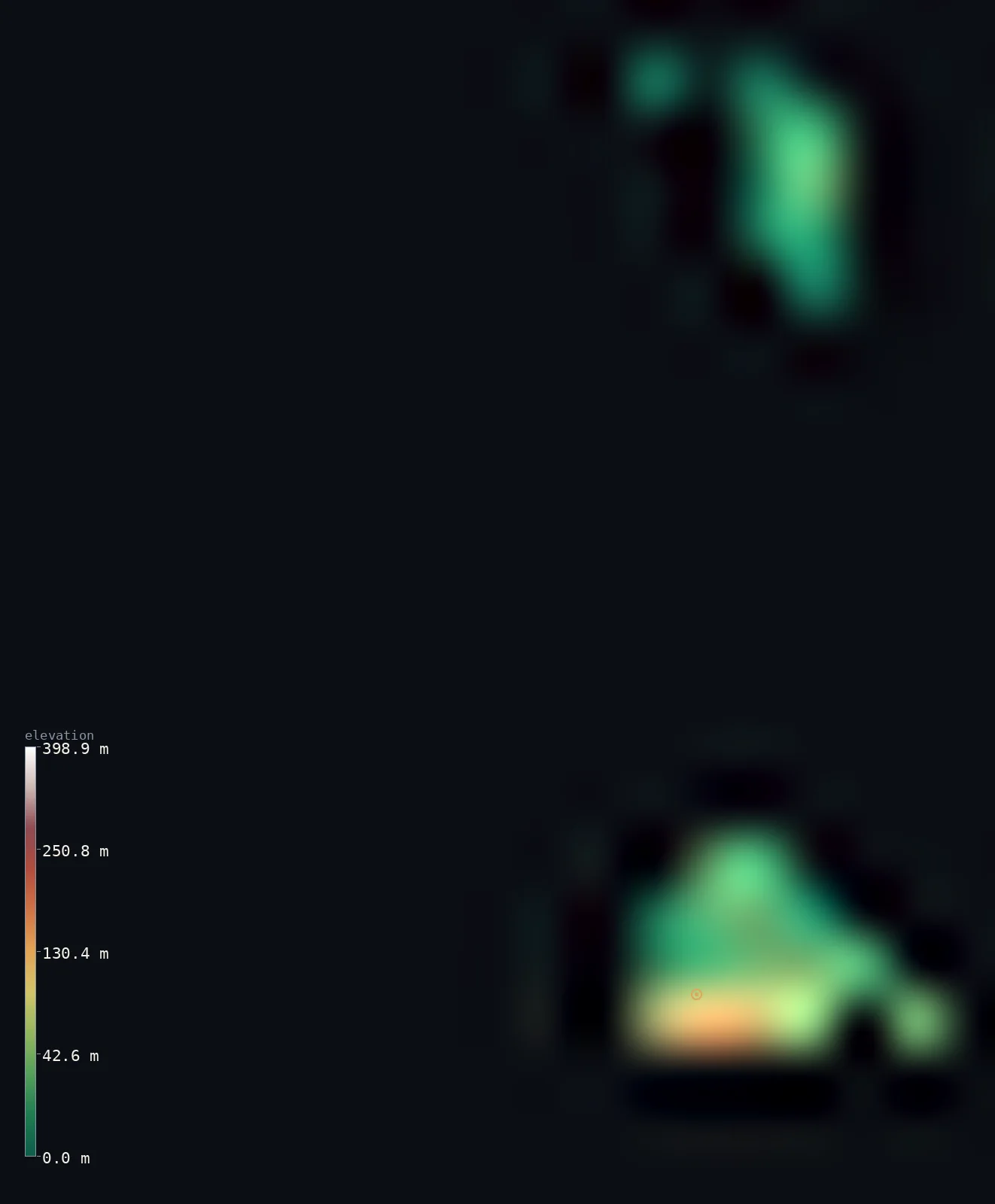
Antigua and Barbuda’s highest point is Boggy Peak (Mount Obama) at 1,319 ft (402 m); its lowest is Caribbean Sea at 0 ft (0 m); the mean elevation is 91 ft (27.7 m).
- Highest point📚
- 1,319 ft402 m
- Boggy Peak (Mount Obama), an old volcanic crater rim in southwestern Antigua.
- Lowest point📚
- 0 ft0 m
- Sea level along the islands' deeply indented Caribbean and Atlantic shores.
- Mean elevation⚙
- 91 ft27.7 m
- Computed from the GLO-30 surface model across both islands.
- Median elevation⚙
- 63 ft19.3 m
- Half of Antigua and Barbuda lies below this height.
- Elevation range📚
- 1,319 ft402 m
- From sea level to Boggy Peak's 402 m summit.
- Above 50 m (164 ft)⚙
- 12%
- The Shekerley Mountains of southwestern Antigua.
- Official area📚
- 171 mi²443 km²
- A small twin-island nation in the Leeward Islands of the eastern Caribbean.
- Forest cover📚
- 18.8%
- Under a fifth of the land is forested — dry tropical woodland and scrub.
Highest and lowest points
The remnant of a volcanic crater in the Shekerley Mountains of southwestern Antigua — the highest point of the country at 402 m. It was renamed Mount Obama in 2009 (honouring US President Barack Obama) and reverted to Boggy Peak in 2016; both names remain in use, and the CIA Factbook still lists it as Mount Obama.
source ↗Antigua and Barbuda at a glance
The country's high point has had three names in a decade: Boggy Peak became Mount Obama in 2009 to honour the US president, then reverted to Boggy Peak in 2016 — though the CIA still lists it as Mount Obama.
source ↗Unlike most of the volcanic Leeward Islands, Antigua is built mainly of limestone and coral, not lava — its lack of high mountains and forests sets it apart from its neighbours.
source ↗Antigua is said to have 365 beaches — 'one for every day of the year' — a result of its deeply indented, reef-fringed coastline.
source ↗Tiny uninhabited Redonda rises almost sheer to about 305 m — far steeper than anything on the two main islands — and was mined for phosphate until 1929.
source ↗Barbuda is so flat (highest point ~44 m) that Hurricane Irma in 2017 stripped vegetation from about 90% of the island and forced the entire population to evacuate to Antigua.
source ↗Because rainfall is low and there are almost no streams or fresh groundwater, the islands suffer recurring droughts despite their tropical setting.
source ↗Barbuda's Codrington Lagoon is one of the largest inland bodies of water in the Lesser Antilles and a major nesting site for frigatebirds.
source ↗
Elevation profile of Antigua and Barbuda
The largest share of land, 28%, falls in the 0–10 m band, and 100% of the territory lies below 500 m (1,640 ft).
- 0–10 m (0–33 ft)28%
- 10–50 m (33–164 ft)60%
- above 50 m (164 ft)12%
Highest peaks of Antigua and Barbuda
| Peak | Elevation | Range | Note |
|---|---|---|---|
| Boggy Peak (Mount Obama)↗ | 1,319 ft402 m | Shekerley Mountains (Antigua) | Highest point of the country, a volcanic crater remnant in southwestern Antigua. |
| Redonda (high point)↗ | 1,001 ft305 m | Redonda islet | A sheer, uninhabited volcanic rock about 40 km southwest of Antigua, rising almost straight from the sea. |
| Barbuda Highlands (Lindsay Hill)↗ | 144 ft44 m | Barbuda Highlands | The highest ground on flat, coral Barbuda — a low limestone plateau east of Codrington. |
Terrain regions of Antigua and Barbuda
The country's high point has had three names in a decade: Boggy Peak became Mount Obama in 2009 to honour the US president, then reverted to Boggy Peak in 2016 — though the CIA still lists it as Mount Obama. ↗
Antigua
↗The larger, more developed main island (~280 km²): a low limestone-and-clay plain with a volcanic southwest holding the Shekerley Mountains and the country's high point, ringed by a deeply indented reef-fringed coast.
Barbuda
↗A flat coral island (~161 km²) 40 km to the north, rising only to ~44 m, fringing the vast Codrington Lagoon and its single town, Codrington.
Redonda
↗A tiny, uninhabited volcanic rock (~1.3 km²) about 40 km southwest of Antigua, rising sheer to ~305 m; once mined for phosphate (guano).
Antigua: central plain and limestone north
most of AntiguaMost of Antigua is a low, gently undulating plain of clay and marl with limestone formations in the north and northeast, ringed by an intricate coastline of bays, headlands, reefs and natural harbours — including English Harbour and St. John's.
Antigua: volcanic southwest (Shekerley Mountains)
southwest AntiguaThe southwestern corner of Antigua is a bulge of volcanic hills, the Shekerley Mountains, rising to Boggy Peak / Mount Obama at 402 m — the only real high ground in the country and the remnant of an old volcanic crater.
Barbuda: flat coral island and Codrington Lagoon
BarbudaBarbuda, 40 km north, is a very flat coral island reaching only ~44 m at the Highlands east of Codrington, wrapped around the large, shallow Codrington Lagoon — a barrier-beach estuary and major seabird habitat. Hurricane Irma stripped its vegetation in 2017.
Redonda and the outer islets
outer isletsThe dependency of Redonda — a precipitous volcanic rock rising ~305 m sheer from the sea southwest of Antigua — plus smaller islets like Guiana and Long Island off Antigua's coast.
City elevations in Antigua and Barbuda
| City | Population | Elevation |
|---|---|---|
| Saint John’scapital | 51,737 | 30 ft9 m |
| Barbuda Parish | 1,634 | 39 ft12 m |
Elevation sampled at each city centre from the Copernicus GLO-30 model. Cities and population from GeoNames (CC-BY 4.0).
Antigua and Barbuda in comparison
Antigua and Barbuda's terrain rises 1,319 ft (402 m) from sea level to Boggy Peak (Mount Obama) — about 5% of the height of Mount Everest, the world's highest point at 29,032 ft (8,849 m).
- The Bahamas's mean elevation is 8 ft — 83 ft lower; its high point, Mount Alvernia (Como Hill), reaches 207 ft (63 m), 1,112 ft below. The Bahamas elevation map →
- Barbados's mean elevation is 341 ft — 250 ft higher; its high point, Mount Hillaby, reaches 1,115 ft (340 m), 203 ft below. Barbados elevation map →
- Saint Kitts and Nevis's mean elevation is 636 ft — 546 ft higher; its high point, Mount Liamuiga, reaches 3,793 ft (1,156 m), 2,474 ft above. Saint Kitts and Nevis elevation map →
Frequently asked questions
What is the highest point in Antigua and Barbuda?
- Boggy Peak — officially renamed Mount Obama in 2009 and reverted in 2016 — at 1,319 ft (402 m), the remnant of a volcanic crater in the Shekerley Mountains of southwestern Antigua.
Why is the highest point called Mount Obama?
- Boggy Peak was renamed Mount Obama in 2009 to honour US President Barack Obama, then officially reverted to Boggy Peak in 2016 — though some sources, including the CIA Factbook, still list it as Mount Obama.
What is the average elevation of Antigua and Barbuda?
- Computed from the Copernicus GLO-30 model, the area-weighted mean is 91 ft (27.7 m). These are low-lying limestone and coral islands, so the mean is very low — only the volcanic southwest of Antigua rises much above the sea.
Are Antigua and Barbuda mountainous?
- Mostly no — they are flat to gently undulating limestone and coral islands. The only real high ground is the volcanic southwest of Antigua, where Boggy Peak reaches 402 m; Barbuda peaks at just ~44 m.
How many islands make up Antigua and Barbuda?
- The two main islands — Antigua and Barbuda, about 40 km apart — plus the small uninhabited islet of Redonda and several lesser islets such as Guiana and Long Island.
What is Redonda?
- A tiny, uninhabited volcanic rock about 40 km southwest of Antigua that rises almost sheer to about 305 m — a dependency of Antigua and Barbuda, once mined for phosphate.
Does Antigua and Barbuda have rivers?
- Effectively no — rainfall is low and there are few streams and little fresh groundwater, so the islands rely on other water sources and suffer periodic droughts.
Is this a topographic, relief, contour, or elevation map of Antigua and Barbuda?
- They describe the same thing — terrain height. This page renders the islands' actual elevation surface in interactive 3D (a relief or topographic view) and reports the elevation statistics computed from it; a contour map shows the same data as lines of equal height.
About this map
The terrain is rendered from the Copernicus GLO-30 digital elevation model (ESA), masked to the ATG-ADM0 boundary from geoBoundaries (gbOpen). Elevation statistics are computed directly from the model; peak names and researched facts are sourced and cited. See the methodology for the full pipeline.
Our area-weighted mean, computed from the Copernicus GLO-30 model, is 91 ft (27.7 m); no authority publishes a mean elevation (CIA World Factbook (no published mean)). These are low-lying limestone and coral islands; apart from the volcanic southwest of Antigua almost all the land is near sea level, so the mean elevation is very low. The page reports the area-weighted figure computed from the Copernicus GLO-30 model.
Surveyed national figures: official area · forest cover · high point.
Rendered from Copernicus GLO-30 (ESA, 2021 release), boundaries from geoBoundaries. Generated 2026-07-25.