How high is Albuquerque?
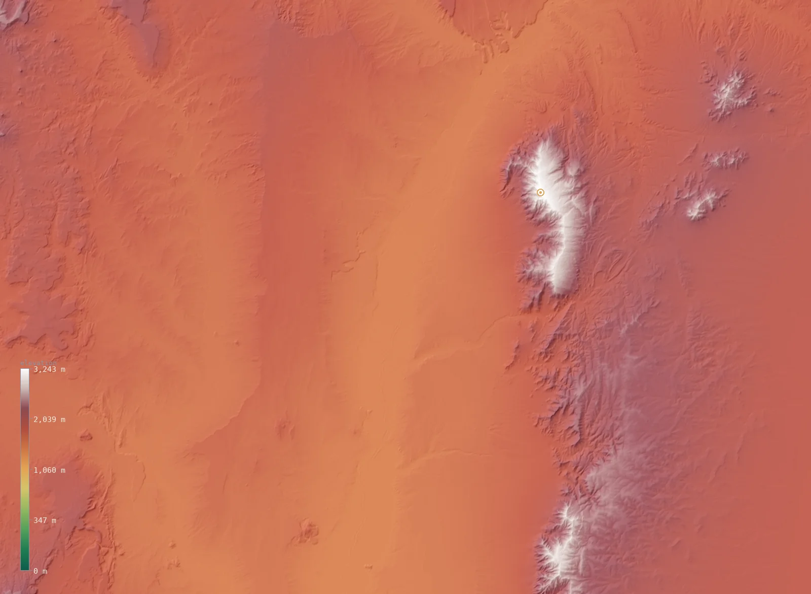
A live 3D slice of the terrain around Albuquerque, from our satellite elevation model. Albuquerque is marked at 4,967 ft (1,514 m); the highest ground in view reaches 10,640 ft (3,243 m). Drag to spin it (tap to start on mobile).
The regional view — Albuquerque.
Elevation across Albuquerque
Zooming into the city itself — Albuquerque’s 28 neighborhoods on real terrain, each marked with its elevation.
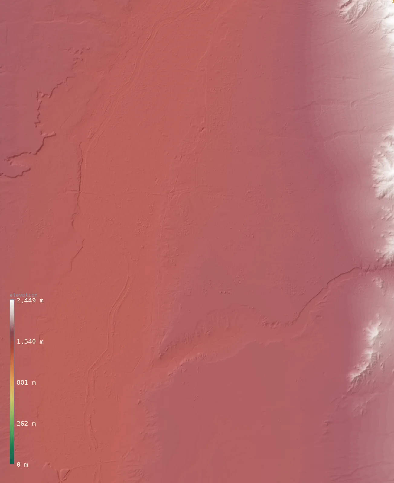
Albuquerque’s neighborhoods span about 800 ft (about 240 m) — from 4,908 ft (1,496 m) at Los Padillas, up to 5,709 ft (1,740 m) at Chelwood Park. Each figure is a Copernicus GLO-30 sample at the neighborhood’s USGS place-name point.
| Neighborhood | Elevation |
|---|---|
| Chelwood Parkhighest | 5,709 ft (1,740 m) |
| La Cuesta | 5,627 ft (1,715 m) |
| Cañada Village | 5,607 ft (1,709 m) |
| Sandia Vista | 5,505 ft (1,678 m) |
| Hoffmantown | 5,479 ft (1,670 m) |
| Buena Ventura | 5,440 ft (1,658 m) |
| Mesa Village | 5,394 ft (1,644 m) |
| Taylor Ranch | 5,331 ft (1,625 m) |
| Vista Encantada | 5,315 ft (1,620 m) |
| Kirtland Addition | 5,105 ft (1,556 m) |
| Alameda | 5,000 ft (1,524 m) |
| Lee Acres | 4,987 ft (1,520 m) |
| Hahn | 4,980 ft (1,518 m) |
| Los Griegos | 4,977 ft (1,517 m) |
| Los Candelarias | 4,970 ft (1,515 m) |
| Martinez Town | 4,964 ft (1,513 m) |
| Los Duranes | 4,964 ft (1,513 m) |
| Kinney | 4,964 ft (1,513 m) |
| Old Town | 4,961 ft (1,512 m) |
| San Jose | 4,961 ft (1,512 m) |
| Mountainview | 4,954 ft (1,510 m) |
| Five Points | 4,951 ft (1,509 m) |
| Atrisco | 4,951 ft (1,509 m) |
| Barelas | 4,948 ft (1,508 m) |
| Armijo | 4,948 ft (1,508 m) |
| Arenal | 4,944 ft (1,507 m) |
| Pajarito | 4,918 ft (1,499 m) |
| Los Padillaslowest | 4,908 ft (1,496 m) |
| Albuquerque (city center) | 4,967 ft (1,514 m) |
Albuquerque in New Mexico
Here’s the useful context: Albuquerque, at 4,967 ft (1,514 m), sits roughly 807 ft (246 m) below New Mexico’s average elevation of 5,774 ft (1,760 m). Despite its reputation it’s on the lower side for its state — our model puts about 64% of New Mexico’s land higher than the city.
The terrain around Albuquerque
Across this view the land rises toward the east. The western third of the frame averages about 5,801 ft (1,768 m); the eastern third about 6,706 ft (2,044 m) — a climb of roughly 906 ft (276 m), topping out near 10,640 ft (3,243 m) at the edge of the frame. That is the mountain front Albuquerque sits against.
You can read the whole story in the map above — the flatter ground where the city sits, and the way the land gathers into peaks nearby. It’s the difference between where you stand and what you can see from it.
What Albuquerque’s altitude means
High-altitude medicine marks about ~8,000 ft (2,400 m) as the line where thin air starts to cause real trouble, and Albuquerque, at 4,967 ft (1,514 m), sits comfortably below it. You won’t get altitude sickness just by arriving. But this is high enough that many people notice something on the first day.
The air is meaningfully thinner than at the coast, so expect a quicker pulse, a little breathlessness on stairs, and faster dehydration in dry air — and alcohol tends to hit harder. None of it is dangerous at this elevation; it just rewards drinking more water and taking the first evening easy.
How Albuquerque compares
Among New Mexico’s larger cities, Albuquerque is ranked #4 of 10 by elevation. For a familiar yardstick, that puts it a bit below Denver’s mile-high 5,280 ft (1,609 m).
- Santa Fe — 7,008 ft (2,136 m)
- Gallup — 6,512 ft (1,985 m)
- Farmington — 5,299 ft (1,615 m)
- Albuquerque — 4,967 ft (1,514 m)
- Alamogordo — 4,341 ft (1,323 m)
- Clovis — 4,272 ft (1,302 m)
- Las Cruces — 3,914 ft (1,193 m)
Albuquerque elevation FAQ
- How high is Albuquerque?
- Albuquerque’s elevation is about 4,967 ft (1,514 m) above sea level at the city center, measured from Copernicus GLO-30 satellite data.
- Is Albuquerque high or low for New Mexico?
- On the low side. At 4,967 ft (1,514 m) it sits below New Mexico’s average of 5,774 ft (1,760 m), with about 64% of the state higher.
- Does Albuquerque’s altitude affect visitors?
- Mildly. At 4,967 ft (1,514 m) it’s below the ~8,000 ft (2,400 m) line where altitude sickness usually begins, but the thinner, drier air can still bring a faster pulse and quicker dehydration on the first day.
Explore more
- ↑ New Mexico’s full elevation map — the whole state in interactive 3D, with its high and low points and average elevation.
- · Blog: Average Elevation by State — where New Mexico’s 5,774 ft (1,760 m) mean ranks.
- · Blog: Elevation vs Altitude — what a city’s elevation figure actually measures.
Albuquerque’s elevation is a native ~30 m windowed-median sample from Copernicus GLO-30 (ESA); the New Mexico figures are computed across the state from the same model. The 3D view is a fine windowed sample at roughly 203 m resolution, sharp enough to resolve the surrounding ridgelines. Neighborhood and landmark place names are from the U.S. Geological Survey’s Geographic Names Information System (GNIS); their elevations are Copernicus GLO-30 samples at each named point. Data as of 2026-08-17.