How high is Crested Butte?
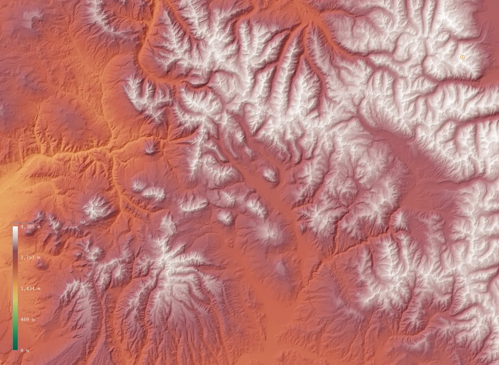
A live 3D slice of the terrain around Crested Butte, from our satellite elevation model. Crested Butte is marked at 8,914 ft (2,717 m); the highest ground in view reaches 14,386 ft (4,385 m). Drag to spin it (tap to start on mobile).
Crested Butte in Colorado
Here’s the useful context: Crested Butte, at 8,914 ft (2,717 m), sits roughly 2,047 ft (624 m) above Colorado’s average elevation of 6,867 ft (2,093 m). It is one of the higher places in its state — our model puts only about 21% of Colorado’s land higher.
The terrain around Crested Butte
Across this view the land rises toward the east. The western third of the frame averages about 8,698 ft (2,651 m); the eastern third about 10,919 ft (3,328 m) — a climb of roughly 2,221 ft (677 m), topping out near 14,386 ft (4,385 m) at the edge of the frame. That is the mountain front Crested Butte sits against.
You can read the whole story in the map above — the flatter ground where the city sits, and the way the land gathers into peaks nearby. It’s the difference between where you stand and what you can see from it.
What Crested Butte’s altitude means
At 8,914 ft (2,717 m), Crested Butte is genuine high-altitude country — at or above the ~8,000 ft (2,400 m) threshold where altitude sickness becomes a real possibility, not just a nuisance. Arriving from sea level, many people feel headache, shortness of breath, poor sleep, and fatigue in the first day or two.
This is ski-town altitude, and the standard advice applies: give yourself a day to acclimatize before hard exertion, drink far more water than feels necessary, ease off alcohol at first, and watch for symptoms that worsen rather than settle. Anyone with a heart or lung condition should take it seriously.
How Crested Butte compares
Among Colorado’s larger cities, Crested Butte is the highest by elevation. For a familiar yardstick, that puts it well above Denver’s mile-high 5,280 ft (1,609 m).
- Crested Butte — 8,914 ft (2,717 m)
- Steamboat Springs — 6,736 ft (2,053 m)
- Durango — 6,549 ft (1,996 m)
- Colorado Springs — 6,020 ft (1,835 m)
- Montrose — 5,814 ft (1,772 m)
- Cañon City — 5,361 ft (1,634 m)
- Denver — 5,285 ft (1,611 m)
Crested Butte elevation FAQ
- How high is Crested Butte?
- Crested Butte’s elevation is about 8,914 ft (2,717 m) above sea level at the city center, measured from Copernicus GLO-30 satellite data.
- Is Crested Butte high or low for Colorado?
- High. At 8,914 ft (2,717 m) it sits above Colorado’s average of 6,867 ft (2,093 m), with only about 21% of the state higher.
- Does Crested Butte’s altitude affect visitors?
- Yes. At 8,914 ft (2,717 m), Crested Butte is at genuine high altitude, near or above the ~8,000 ft (2,400 m) line where altitude sickness is a real risk; give yourself a day to acclimatize and hydrate hard.
Explore more
- ↑ Colorado’s full elevation map — the whole state in interactive 3D, with its high and low points and average elevation.
- · Blog: Average Elevation by State — where Colorado’s 6,867 ft (2,093 m) mean ranks.
- · Blog: Elevation vs Altitude — what a city’s elevation figure actually measures.
Crested Butte’s elevation is a native ~30 m windowed-median sample from Copernicus GLO-30 (ESA); the Colorado figures are computed across the state from the same model. The 3D view is a fine windowed sample at roughly 209 m resolution, sharp enough to resolve the surrounding ridgelines. Data as of 2026-08-19.