Palau Elevation Map — Topographic & 3D Terrain
Explore the terrain of Palau in interactive 3D, built from Copernicus GLO-30 satellite elevation data — a low archipelago of one hilly volcanic island and many low coral and limestone islands. Drag to rotate, scroll to zoom, and tap any point to read its elevation.
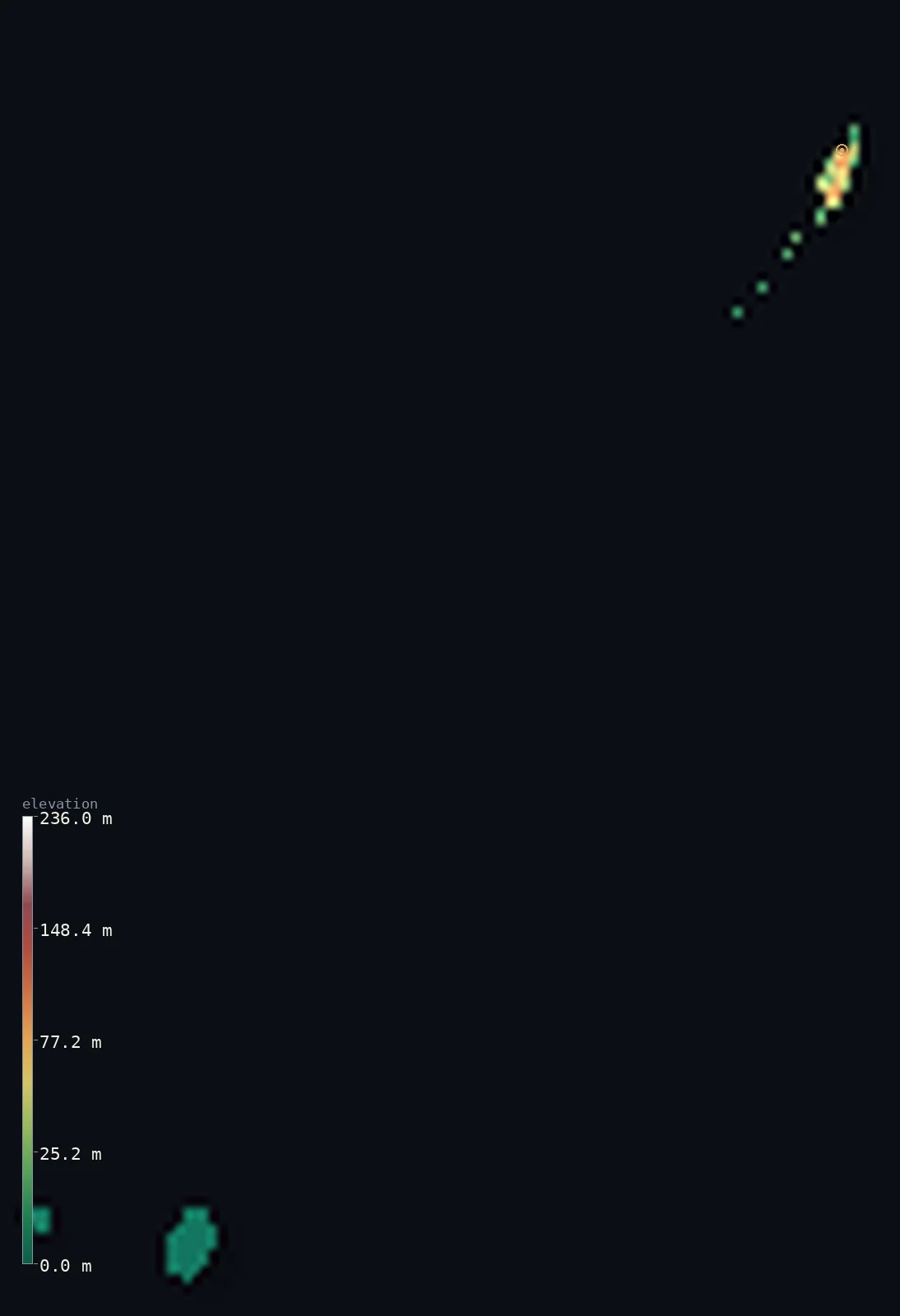
Palau’s highest point is Mount Ngerchelchuus at 794 ft (242 m); its lowest is Pacific Ocean at 0 ft (0 m); the mean elevation is 56 ft (17.1 m).
Palau is a low archipelago with almost all its height on one island. Babeldaob, the large volcanic main island, holds over 70% of the land and nearly all the relief — a rolling jungle upland rising in the northwest to Mount Ngerchelchuus at 794 ft (242 m), the national high point. Everything else is low: Koror and the celebrated limestone Rock Islands in a great barrier-reef lagoon, the raised platforms of Peleliu and Angaur, and remote outer atolls. So half of Palau lies at or barely above sea level.
- Highest point📚
- 794 ft242 m
- Palau's highest point is Mount Ngerchelchuus at 794 ft (242 m), a forested summit in the northwest of Babeldaob, the large volcanic main island — a rolling jungle upland. As an isolated archipelago Palau has no land borders.
- Lowest point📚
- 0 ft0 m
- Palau's lowest point is sea level, across its many low coral and limestone islands — the Rock Islands, the raised platforms of Peleliu and Angaur, and the outer atolls, most only a little above the lagoon.
- Mean elevation⚙
- 56 ft17.1 m
- Computed from the GLO-30 model, Palau's mean elevation is 56 ft (17.1 m) — very low, for almost all of Palau is low coral and limestone islands; half of the country lies at or barely above sea level (0 ft (0 m)). Nearly all the relief is on one island, volcanic Babeldaob, rising to Mount Ngerchelchuus.
- Median elevation⚙
- 0 ft0 m
- Half of Palau lies at or barely above sea level (about 0 ft (0 m)) — the country is mostly low coral and limestone: the Rock Islands, the platform islands, and the outer atolls. The only real high ground is the volcanic main island, Babeldaob.
- Elevation range📚
- 794 ft242 m
- From the sea to Mount Ngerchelchuus at 242 m on Babeldaob, Palau's terrain spans about 794 ft — from coral lagoon and limestone knob up to the jungle crown of the one volcanic island.
- Above 50 m (164 ft)⚙
- 14%
- About 14% of Palau rises above 50 m (164 ft) — almost all of it the rolling volcanic upland of Babeldaob. The rest — the Rock Islands, the platform islands, the atolls — lies low, at or near the level of the lagoon.
- Official area📚
- 177 mi²459 km²
- Palau covers about 177 sq mi (459 sq km) of land — an isolated archipelago of one hilly volcanic island, Babeldaob (over 70% of the land), plus Koror, the celebrated limestone Rock Islands, the platform islands of Peleliu and Angaur, and remote outer atolls, most within a single barrier-reef lagoon.
- Forest cover📚
- 87.6%
- About 88% of Palau is forested — jungle over the volcanic upland of Babeldaob, thick mangrove along its coasts, and dense forest on the steep limestone knobs of the Rock Islands.
Highest and lowest points
Palau's highest point is Mount Ngerchelchuus (also Makelulu), 794 ft (242 m), a forested summit in the northwest of Babeldaob, the large volcanic main island. Unlike the rest of the country — low coral and limestone — Babeldaob is a rolling jungle upland incised by rivers, and Ngerchelchuus is its highest ground. It is a modest summit, but on so low an archipelago it is the one real hill; from it the land rolls down to mangrove coasts and out to the lagoon, the Rock Islands and the atolls, almost all barely above the sea.
source ↗Palau's lowest ground is sea level, across an archipelago that is nearly all low coral and limestone. Its one exception is Babeldaob, the large volcanic main island — over 70% of the land — a rolling upland of jungle and grassland incised by rivers, rising in the northwest to Mount Ngerchelchuus (242 m, the highest point), its coasts thick with mangrove. South of it, Koror and the famous Rock Islands sit in a great barrier-reef lagoon: hundreds of small, steep, forested limestone knobs of uplifted ancient coral, riddled with hidden marine lakes — one of the most distinctive seascapes in the Pacific. Beyond lie the raised platform islands of Peleliu and Angaur, the low Kayangel atoll to the north, and, some 290 km to the southwest, the tiny Southwest Islands, Palau's remote outliers.
source ↗Palau at a glance
Almost all of Palau's relief is on one island: Babeldaob holds over 70% of the land and the only real high ground, rising to 242 m.
source ↗Palau's capital, Ngerulmud, is the least populous national capital on Earth, with only a few hundred people.
source ↗The Rock Islands are hundreds of mushroom-shaped limestone islets, uplifted from ancient coral reefs, dotted with hidden marine lakes.
source ↗Palau's most remote islands - Sonsorol, Pulo Anna and Tobi - lie about 290 km southwest of the main group, with their own languages.
source ↗Most of Palau's islands sit inside a single barrier-reef lagoon stretching some 115 km.
source ↗
Elevation profile of Palau
The largest share of land, 64%, falls in the 0–10 m band, and 100% of the territory lies below 500 m (1,640 ft).
- 0–10 m (0–33 ft)64%
- 10–50 m (33–164 ft)22%
- above 50 m (164 ft)14%
Highest peaks of Palau
| Peak | Elevation | Range | Note |
|---|---|---|---|
| Mount Ngerchelchuus↗ | 794 ft242 m | Babeldaob (main island) | Highest point of Palau, a forested upland summit in northwest Babeldaob. |
Palau: Babeldaob the volcanic main island, the lagoon and Rock Islands, and the platform islands and outer atolls
Babeldaob — the volcanic main island
Babeldaob is by far the largest island, over 70% of Palau's land. Unlike the rest of the country it is hilly and volcanic — a rolling upland of jungle and grassland incised by rivers, rising in the northwest to Mount Ngerchelchuus (242 m), the national high point, its coasts fringed with thick mangrove.
The lagoon and Rock Islands
South of Babeldaob, Koror and the celebrated Rock Islands sit within a great barrier-reef lagoon. The Rock Islands are hundreds of small, steep, forested limestone knobs — uplifted ancient coral riddled with marine lakes and sinkholes — one of the most distinctive seascapes in the Pacific.
The platform islands and outer atolls
To the south lie the raised coral platform islands of Peleliu and Angaur, and to the north the low Kayangel atoll. Far to the southwest, some 290 km away, the tiny Southwest Islands (Sonsorol, Pulo Anna and Tobi) form Palau's remote outliers — each a few square kilometres of low coral.
How to read this map
Color shows elevation; the raised relief shows real terrain. On this map Palau reads as one green upland among low coral — the rolling browns of Babeldaob (highest at Mount Ngerchelchuus), with the maze of the Rock Islands and the outer platforms and atolls barely tinted above the lagoon.
Because almost all of Palau is low, the 3D relief is the actual GLO-30 elevation data exaggerated so Babeldaob's modest upland shows above the flat coral; the ×N relief slider controls how much. Tap anywhere to read that point's exact elevation.
Palau in comparison
Palau's terrain rises 794 ft (242 m) from sea level to Mount Ngerchelchuus — about 3% of the height of Mount Everest, the world's highest point at 29,032 ft (8,849 m).
- Micronesia's mean elevation is 499 ft — 443 ft higher; its high point, Mount Nanlaud, reaches 2,566 ft (782 m), 1,772 ft above. Micronesia elevation map →
- Marshall Islands's mean elevation is 2 ft — 54 ft lower; its high point, Likiep high point (unnamed), reaches 33 ft (10 m), 761 ft below. Marshall Islands elevation map →
- Nauru's mean elevation is 79 ft — 23 ft higher; its high point, Command Ridge, reaches 213 ft (65 m), 581 ft below. Nauru elevation map →
Frequently asked questions
What is the highest point in Palau?
- Mount Ngerchelchuus, 794 ft (242 m), a forested summit on the main island of Babeldaob.
What is the average elevation of Palau?
- No authoritative source publishes one. Computed from the Copernicus GLO-30 model, the area-weighted mean is 56 ft (17.1 m). Palau is a low archipelago with high ground only on Babeldaob.
What is the lowest point in Palau?
- Sea level, across its many low coral and limestone islands.
What are the Rock Islands?
- Hundreds of small, steep, forested limestone islets in Palau's central lagoon - uplifted ancient coral riddled with marine lakes, and a UNESCO World Heritage Site.
Is this a topographic, relief, contour, or elevation map of Palau?
- They describe the same thing - terrain height. This page renders Palau's actual elevation surface in interactive 3D (a relief or topographic view) and reports the elevation statistics computed from it; a contour map shows the same data as lines of equal height.
About this map
The terrain is rendered from the Copernicus GLO-30 digital elevation model (ESA), masked to the PLW-ADM0 boundary from geoBoundaries (gbOpen). Elevation statistics are computed directly from the model; peak names and researched facts are sourced and cited. See the methodology for the full pipeline.
Our area-weighted mean, computed from the Copernicus GLO-30 model, is 56 ft (17.1 m); no authority publishes a mean elevation (no authoritative published mean). Palau is a low archipelago with its height on a single island. Babeldaob, the large volcanic main island, holds over 70% of the land and nearly all the relief — a rolling jungle upland incised by rivers, rising in the northwest to Mount Ngerchelchuus (242 m), the national high point. Everything else is low: Koror and the celebrated Rock Islands (hundreds of steep limestone knobs of uplifted ancient coral, riddled with marine lakes) inside a great barrier-reef lagoon, the raised platforms of Peleliu and Angaur, and the remote Southwest Islands. So half of Palau lies at or barely above sea level. No authoritative source publishes a mean; the figure here is computed from the GLO-30 model.
Surveyed national figures: official area · forest cover · high point.
Rendered from Copernicus GLO-30 (ESA, 2021 release), boundaries from geoBoundaries. Generated 2026-07-20.