How high is Cheyenne?
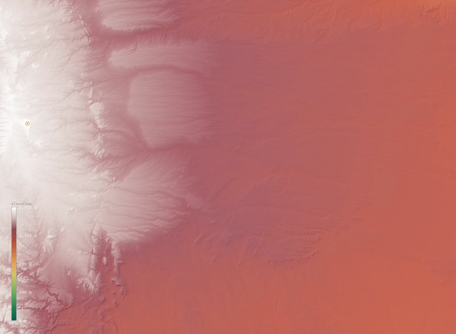
A live 3D slice of the terrain around Cheyenne, from our satellite elevation model. Cheyenne is marked at 6,096 ft (1,858 m); the highest ground in view reaches 9,022 ft (2,750 m). Drag to spin it (tap to start on mobile).
Cheyenne: the second-highest US state capital
At 6,062 feet (1,848 meters), Cheyenne is the second-highest US state capital — behind Santa Fe at 7,199 feet (2,194 meters), ahead of Denver at 5,280 feet (1,609 meters). The elevations settle the ordering by themselves.
Sources: USA Symbol — state capitals by elevation
Cheyenne in Wyoming
Here’s the useful context: Cheyenne, at 6,096 ft (1,858 m), sits roughly 302 ft (92 m) below Wyoming’s average elevation of 6,398 ft (1,950 m). Despite its reputation it’s on the lower side for its state — our model puts about 57% of Wyoming’s land higher than the city.
The terrain around Cheyenne
Across this view the land rises toward the west. The eastern third of the frame averages about 5,436 ft (1,657 m); the western third about 7,169 ft (2,185 m) — a climb of roughly 1,736 ft (529 m), topping out near 9,022 ft (2,750 m) at the edge of the frame. That is the mountain front Cheyenne sits against.
You can read the whole story in the map above — the flatter ground where the city sits, and the way the land gathers into peaks nearby. It’s the difference between where you stand and what you can see from it.
What Cheyenne’s altitude means
At 6,096 ft (1,858 m), Cheyenne is high enough that most visitors feel it, even though it’s still below the ~8,000 ft (2,400 m) line where altitude sickness typically begins. The first day or two can bring shortness of breath, a faster heart rate, trouble sleeping, and quicker dehydration.
The fix is patience: arrive, hydrate hard, go easy on alcohol and hard exertion, and let your body adjust over a day or two. Most people feel normal by the second or third day. If you’re heading higher into the mountains from here, the effects only grow.
How Cheyenne compares
Among Wyoming’s larger cities, Cheyenne is ranked #5 of 10 by elevation. For a familiar yardstick, that puts it a bit above Denver’s mile-high 5,280 ft (1,609 m).
- Evanston — 6,752 ft (2,058 m)
- Rock Springs — 6,404 ft (1,952 m)
- Jackson — 6,243 ft (1,903 m)
- Cheyenne — 6,096 ft (1,858 m)
- Casper — 5,108 ft (1,557 m)
- Cody — 4,997 ft (1,523 m)
- Riverton — 4,954 ft (1,510 m)
Cheyenne elevation FAQ
- How high is Cheyenne?
- Cheyenne’s elevation is about 6,096 ft (1,858 m) above sea level at the city center, measured from Copernicus GLO-30 satellite data.
- Is Cheyenne high or low for Wyoming?
- On the low side. At 6,096 ft (1,858 m) it sits below Wyoming’s average of 6,398 ft (1,950 m), with about 57% of the state higher.
- Does Cheyenne’s altitude affect visitors?
- Often, yes. At 6,096 ft (1,858 m) most visitors feel the thinner air for a day or two — shortness of breath, poor sleep, dehydration — before adjusting.
Explore more
- ↑ Wyoming’s full elevation map — the whole state in interactive 3D, with its high and low points and average elevation.
- · Blog: Average Elevation by State — where Wyoming’s 6,398 ft (1,950 m) mean ranks.
- · Blog: Elevation vs Altitude — what a city’s elevation figure actually measures.
Cheyenne’s elevation is a native ~30 m windowed-median sample from Copernicus GLO-30 (ESA); the Wyoming figures are computed across the state from the same model. The 3D view is a fine windowed sample at roughly 212 m resolution, sharp enough to resolve the surrounding ridgelines. Data as of 2026-08-19.