How high is Tucson?
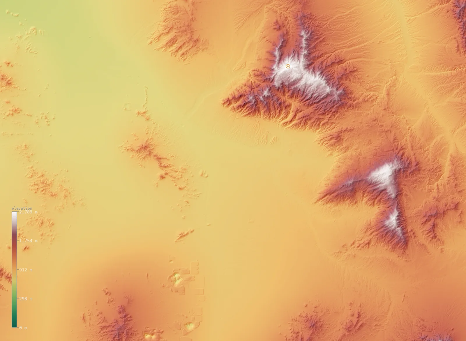
A live 3D slice of the terrain around Tucson, from our satellite elevation model. Tucson is marked at 2,484 ft (757 m); the highest ground in view reaches 9,150 ft (2,789 m). Drag to spin it (tap to start on mobile).
The regional view — Tucson.
Elevation across Tucson
Zooming into the city itself — Tucson’s 18 neighborhoods on real terrain, each marked with its elevation.
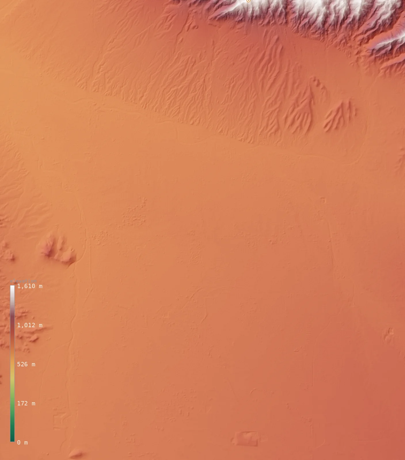
Tucson’s neighborhoods span about 580 ft (about 180 m) — from 2,287 ft (697 m) at Stockham, up to 2,864 ft (873 m) at Skyline Bel Aire Estates. Each figure is a Copernicus GLO-30 sample at the neighborhood’s USGS place-name point.
| Neighborhood | Elevation |
|---|---|
| Skyline Bel Aire Estateshighest | 2,864 ft (873 m) |
| Rankin | 2,782 ft (848 m) |
| Littletown | 2,720 ft (829 m) |
| Vandenberg Village | 2,657 ft (810 m) |
| Craycroft | 2,585 ft (788 m) |
| Kingston Knolls Terrace | 2,582 ft (787 m) |
| Polvo | 2,556 ft (779 m) |
| Emery Park | 2,539 ft (774 m) |
| Indian Ridge Estates | 2,513 ft (766 m) |
| Valley View | 2,490 ft (759 m) |
| Pueblo Gardens | 2,487 ft (758 m) |
| Tucson Country Club Estates | 2,477 ft (755 m) |
| Polo Village | 2,451 ft (747 m) |
| Oracle Foothills Estates | 2,441 ft (744 m) |
| Amphitheater | 2,339 ft (713 m) |
| El Rio | 2,333 ft (711 m) |
| Gardner Estates | 2,290 ft (698 m) |
| Stockhamlowest | 2,287 ft (697 m) |
| Tucson (city center) | 2,484 ft (757 m) |
Tucson in Arizona
Here’s the useful context: Tucson, at 2,484 ft (757 m), sits roughly 1,732 ft (528 m) below Arizona’s average elevation of 4,216 ft (1,285 m). Despite its reputation it’s on the lower side for its state — our model puts about 74% of Arizona’s land higher than the city.
The terrain around Tucson
Across this view the land rises toward the east. The western third of the frame averages about 2,615 ft (797 m); the eastern third about 4,127 ft (1,258 m) — a climb of roughly 1,512 ft (461 m), topping out near 9,150 ft (2,789 m) at the edge of the frame. That is the mountain front Tucson sits against.
You can read the whole story in the map above — the flatter ground where the city sits, and the way the land gathers into peaks nearby. It’s the difference between where you stand and what you can see from it.
What Tucson’s altitude means
At 2,484 ft (757 m), Tucson is low enough that altitude barely registers. The air holds close to the oxygen your body expects nearer sea level, so arriving here brings none of the breathlessness or fast dehydration that higher cities do. If altitude is on your mind, this isn’t the place to worry about it.
How Tucson compares
Among Arizona’s larger cities, Tucson is ranked #5 of 10 by elevation. For a familiar yardstick, that puts it well below Denver’s mile-high 5,280 ft (1,609 m).
- Prescott Valley — 5,013 ft (1,528 m)
- Sierra Vista — 4,639 ft (1,414 m)
- Agua Prieta — 4,012 ft (1,223 m)
- Tucson — 2,484 ft (757 m)
- San Tan Valley — 1,519 ft (463 m)
- Phoenix — 1,096 ft (334 m)
- Lake Havasu City — 741 ft (226 m)
Tucson elevation FAQ
- How high is Tucson?
- Tucson’s elevation is about 2,484 ft (757 m) above sea level at the city center, measured from Copernicus GLO-30 satellite data.
- Is Tucson high or low for Arizona?
- On the low side. At 2,484 ft (757 m) it sits below Arizona’s average of 4,216 ft (1,285 m), with about 74% of the state higher.
- Does Tucson’s altitude affect visitors?
- Not really. At 2,484 ft (757 m), Tucson is low enough that the air feels much like it does near sea level.
Explore more
- ↑ Arizona’s full elevation map — the whole state in interactive 3D, with its high and low points and average elevation.
- · Blog: Average Elevation by State — where Arizona’s 4,216 ft (1,285 m) mean ranks.
- · Blog: Elevation vs Altitude — what a city’s elevation figure actually measures.
Tucson’s elevation is a native ~30 m windowed-median sample from Copernicus GLO-30 (ESA); the Arizona figures are computed across the state from the same model. The 3D view is a fine windowed sample at roughly 200 m resolution, sharp enough to resolve the surrounding ridgelines. Neighborhood and landmark place names are from the U.S. Geological Survey’s Geographic Names Information System (GNIS); their elevations are Copernicus GLO-30 samples at each named point. Data as of 2026-08-19.